Evolutionary Algorithms and Artificial Neural Networks for Advanced Landslide Susceptibility Mapping: A Comprehensive Guide
Landslide Susceptibility Mapping (LSM) is a critical tool for disaster risk reduction and land-use planning.
Evolutionary Algorithms and Artificial Neural Networks for Advanced Landslide Susceptibility Mapping: A Comprehensive Guide
Abstract
Landslide Susceptibility Mapping (LSM) is a critical tool for disaster risk reduction and land-use planning. This article provides a comprehensive exploration of integrating Evolutionary Algorithms (EAs) with Artificial Neural Networks (ANNs) to create robust, accurate, and interpretable landslide susceptibility models. We cover the foundational principles of this hybrid approach, detail the implementation of various optimization algorithms like COA, HS, SFS, and TLBO, and address key challenges such as hyperparameter tuning, non-landslide sample selection, and model overfitting. The article further presents rigorous validation and comparative analysis techniques, including performance metrics like AUC-ROC and geomorphic plausibility tests, to benchmark these models against traditional methods. Aimed at researchers, geoscientists, and engineers, this guide synthesizes cutting-edge methodologies to advance the field of geohazard assessment.
The Foundation of Hybrid EA-ANN Models for Landslide Risk Assessment
Landslide Susceptibility Mapping (LSM) represents a fundamental proactive tool in geological risk management, enabling the identification of areas prone to landsliding based on local terrain conditions and triggering factors. As a destructive natural disaster, landslides cause extensive damage to vegetation, infrastructure, and property, often resulting in substantial loss of life and economic damage [1]. The integration of sophisticated computational approaches, particularly evolutionary algorithms combined with artificial neural networks (ANN), has significantly advanced the predictive accuracy of LSM models in recent years. These technological advancements coincide with growing recognition of the profound socio-economic consequences of landslides, which extend beyond immediate physical damage to encompass long-term impacts on community resilience, economic stability, and sustainable development, particularly in impoverished regions where recovery capacity is limited [1]. This article explores the integration of evolutionary algorithm-based ANN approaches in LSM and examines their critical relationship with socio-economic impact assessment, providing application notes and experimental protocols for researchers and disaster risk management professionals.
Theoretical Foundations and Current Approaches
Landslide susceptibility refers to the spatial probability of landslide occurrences, helping to identify high-risk areas based on the interaction of multiple causative factors [1]. Current LSM methodologies generally fall into two categories: qualitative (knowledge-driven) and quantitative (data-driven) approaches [2]. Qualitative methods, including the analytical hierarchy process (AHP) and fuzzy logic, rely on expert judgment and are inherently subjective [3] [1]. Quantitative approaches encompass statistical, probabilistic, and increasingly, machine learning techniques that learn the complex, non-linear relationships between landslide occurrences and multiple predisposing factors [4] [2].
The integration of socio-economic factors into LSM represents a paradigm shift from purely geological approaches to more holistic risk assessment frameworks. Traditional models relying purely on geological data fail to address social vulnerabilities that may be most critical in determining impact scenarios of disaster events [5]. Social vulnerability encompasses socio-economic factors like population density, economic status, and infrastructure quality, influencing a community's preparedness, response, and recovery capacity [5]. This integration is particularly crucial given the significant socio-economic impacts of landslides, which claim tens of thousands of lives globally and cause an estimated $20 billion in annual economic losses [6].
Table 1: Key Socio-Economic Impacts of Landslides
| Impact Category | Specific Consequences | Regional Examples |
|---|---|---|
| Human Costs | Fatalities, injuries, displacement | 66,438 deaths globally (1900-2020) [7] |
| Direct Economic Losses | Infrastructure damage, property destruction | $10 billion economic losses (1900-2020) [7], $300 million annual average in Germany [6] |
| Indirect Economic Impacts | Disrupted transportation, reduced agricultural productivity, decreased property values | Hindered resource development and economic growth in mountainous regions [1] |
| Social Disruption | Community displacement, psychological trauma, public service interruption | Exacerbated poverty in contiguous impoverished areas of Liangshan, China [1] |
Evolutionary Algorithms and ANN in LSM: Mechanisms and Workflows
Evolutionary algorithms (EAs) represent a class of population-based metaheuristic optimization algorithms inspired by biological evolution. In LSM, EAs are primarily employed to optimize the structural parameters of ANN models and select optimal feature subsets from multiple landslide conditioning factors [2]. The synergy between EAs and ANN addresses several limitations of standalone ANN applications, including computational complexity, over-fitting problems, and challenges in tuning structural parameters [2].
The most commonly implemented evolutionary algorithms in LSM include Genetic Algorithms (GA), Particle Swarm Optimization (PSO), Non-dominated Sorting Genetic Algorithm II (NSGA-II), and Evolutionary Non-dominated Radial Slots-Based Algorithm (ENORA) [2] [7]. These algorithms enhance ANN performance through two primary mechanisms: feature selection optimization and structural parameter tuning. Feature selection reduces the effects of the "curse of dimensionality" by identifying the most relevant landslide conditioning factors, while parameter tuning optimizes ANN architecture parameters such as learning rate, number of hidden layers, and activation functions [2].
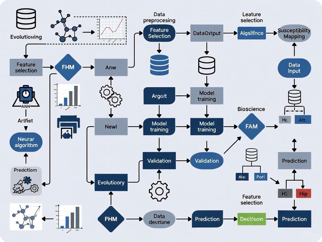
Diagram 1: Integrated workflow for evolutionary algorithm-ANN based landslide susceptibility mapping and socio-economic impact assessment
Experimental Protocols and Application Notes
Protocol 1: Development of Evolutionary ANN for LSM
Objective: To create an optimized ANN model using evolutionary algorithms for accurate landslide susceptibility mapping with integration of socio-economic factors.
Materials and Software Requirements:
- Geographical Information System (GIS) software (e.g., ArcGIS, QGIS)
- Programming environment (e.g., Python with TensorFlow/Keras, MATLAB)
- Spatial database management system
- High-resolution digital elevation models (DEM)
- Remote sensing data (e.g., Landsat imagery, InSAR data)
Methodological Steps:
Landslide Inventory Mapping:
Conditioning Factor Selection:
- Select relevant landslide conditioning factors based on literature review and regional characteristics
- Key factors typically include: topographic (elevation, slope, aspect), geological (lithology, distance to faults), hydrological (distance to rivers, rainfall), environmental (NDVI, land use), and socio-economic factors (population density, infrastructure) [1] [7]
- Process all factors to a consistent spatial resolution and coordinate system
Evolutionary Algorithm Optimization:
- Initialize population of potential solutions (ANN parameters and feature subsets)
- Define fitness function based on prediction accuracy (e.g., AUC, F1-score)
- Implement selection, crossover, and mutation operations (for GA) or position/velocity updates (for PSO)
- Iterate until convergence criteria met (e.g., maximum generations, fitness threshold)
ANN Model Training and Validation:
- Train ANN model using optimized parameters and feature subset
- Validate model performance using area under receiver operating characteristic curve (AUC), accuracy, precision, recall, and F1-score [4]
- Generate final landslide susceptibility map classified into very low, low, moderate, high, and very high susceptibility zones
Table 2: Performance Metrics of Evolutionary Algorithm-Optimized ANN Models in LSM
| Algorithm Combination | Study Region | Performance Metrics | Key Conditioning Factors Identified |
|---|---|---|---|
| COA-MLP [4] | Gilan, Iran | AUC: 0.995 (testing) | 16 topographic, geomorphologic, geological, land use, and hydrological factors |
| PSO-ANN [2] | Achaia, Greece | AUC: 0.969 (training), 0.800 (validation) | Elevation, slope angle, slope aspect, curvature, distance to faults |
| NSGA-II-Fuzzy [7] | Khalkhal, Iran | AUC: 0.867, RMSE: 0.43 (validation) | Lithology, land cover, altitude |
| Hybrid RF-GB [5] | Multiple | Accuracy: 92%, Precision: 0.89, F1-score: 0.90 | Geological and social vulnerability factors |
Protocol 2: Integration of Socio-Economic Vulnerability Assessment
Objective: To incorporate socio-economic vulnerability factors into LSM for comprehensive risk assessment.
Methodological Steps:
Socio-Economic Data Collection:
- Collect demographic data (population density, age distribution)
- Gather economic data (income levels, property values, infrastructure distribution)
- Acquire land use and planning data (settlement patterns, critical facilities)
Social Vulnerability Index Calculation:
- Normalize socio-economic indicators to common scale
- Apply principal component analysis (PCA) to reduce dimensionality [5]
- Calculate composite social vulnerability index
Integrated Risk Assessment:
- Combine physical susceptibility map with social vulnerability index
- Apply catastrophe theory to model discontinuous changes and threshold effects [1]
- Implement the Landslide Misjudgment Potential Societal Loss Evaluation Index (LMPSLEI) to quantify potential losses from false negatives and false positives [8]
Climate Change Scenario Integration:
- Utilize CMIP6 climate projections under different SSP-RCP scenarios [9]
- Model changes in rainfall patterns and extreme weather events
- Project future landslide susceptibility under climate change scenarios
- Assess future population and economic exposure to landslide hazards
Diagram 2: Evolutionary algorithm optimization process for ANN parameter tuning in LSM
Table 3: Essential Research Toolkit for Evolutionary Algorithm-Based LSM Research
| Tool Category | Specific Tools/Software | Application in LSM Research | Key Functions |
|---|---|---|---|
| GIS Software | ArcGIS, QGIS, GRASS GIS | Spatial data management, analysis, and visualization | Geoprocessing, map algebra, susceptibility visualization |
| Remote Sensing Data | Landsat, Sentinel, ASTER DEM, LiDAR | Terrain analysis, land cover classification, change detection | Deriving conditioning factors (slope, aspect, curvature, NDVI) |
| Machine Learning Libraries | TensorFlow, Keras, Scikit-learn, WEKA | Implementing ANN and evolutionary algorithms | Model development, training, and validation |
| Evolutionary Algorithm Frameworks | DEAP, Platypus, JMetal | Implementing optimization algorithms | Parameter tuning, feature selection |
| Statistical Analysis Tools | R, SPSS, MATLAB | Statistical analysis and model validation | Performance evaluation, significance testing |
| Climate Projection Data | CMIP6 model outputs | Future scenario analysis | Projecting climate change impacts on landslide susceptibility [9] |
| Socio-Economic Data | Census data, night light data, land use maps | Social vulnerability assessment | Quantifying socioeconomic exposure and vulnerability [9] |
Data Analysis and Interpretation Guidelines
Model Validation Techniques
Robust validation of LSM models is essential for reliability in practical applications. The area under the receiver operating characteristic curve (AUC) represents the most widely adopted validation metric, with values above 0.8 indicating good performance and above 0.9 indicating excellent performance [4] [2]. Additional statistical measures including accuracy, precision, recall, F1-score, and root mean square error (RMSE) provide comprehensive assessment of model performance [5] [7].
Spatial validation through field verification represents a critical step in model assessment. This involves selecting random points across different susceptibility classes and conducting ground truthing to verify model predictions [3]. Comparative analysis with independent landslide inventories or historical records further validates model robustness and temporal transferability.
Interpretation of Integrated Socio-Economic Results
The integration of socio-economic factors necessitates specialized interpretation frameworks. The Landslide Misjudgment Potential Societal Loss Evaluation Index (LMPSLEI) provides a quantitative measure of potential societal losses resulting from model errors, giving greater weight to false negatives (undetected landslides) due to their typically more severe consequences [8]. This approach represents a significant advancement beyond pure statistical metrics by explicitly incorporating the asymmetric impact of different error types.
Future scenario analysis under climate change and socioeconomic development pathways enables proactive risk management. Studies project potential landslide activities over mainland China to increase by 20.6% to 46.5% by the end of the 21st century depending on emission scenarios, with parallel increases in population and economic exposure in most scenarios [9]. Such analyses help prioritize regions for intervention and guide adaptation planning.
The integration of evolutionary algorithms with artificial neural networks represents a powerful methodological advancement in landslide susceptibility mapping, significantly enhancing model accuracy and robustness through optimized parameter tuning and feature selection. The concurrent incorporation of socio-economic factors transforms LSM from a purely physical assessment to a comprehensive risk evaluation tool that directly addresses the human dimensions of landslide impacts.
Implementation of these advanced LSM approaches provides valuable insights for disaster prevention, poverty alleviation, and sustainable development strategies, particularly in vulnerable regions [1]. The proposed protocols and application notes offer researchers and practitioners a structured framework for developing integrated physical-socioeconomic landslide risk assessments. Future research directions should focus on enhancing model transferability across regions, improving the temporal resolution of susceptibility assessments, and strengthening the linkage between susceptibility mapping and decision-making processes for land use planning and emergency preparedness.
The Role of Artificial Neural Networks (ANNs) in Capturing Complex Landslide Patterns
Landslides represent one of the most destructive natural hazards globally, causing significant loss of life and extensive damage to infrastructure and the environment [4]. The complex, nonlinear interactions between multiple conditioning factors—including topography, geology, hydrology, and land use—make landslide pattern recognition and susceptibility mapping particularly challenging. Artificial Neural Networks (ANNs) have emerged as powerful computational tools capable of learning these complex, high-dimensional relationships from geospatial data, offering significant advantages over traditional statistical methods for landslide susceptibility assessment [10] [11].
When integrated with evolutionary optimization algorithms, ANNs demonstrate enhanced capability to identify optimal network architectures and parameters, substantially improving prediction accuracy for landslide patterns [4] [10]. This integration represents a significant advancement in geohazard assessment, enabling more reliable identification of susceptible areas for disaster mitigation and land-use planning.
Performance Analysis of Evolutionary Algorithm-Optimized ANNs
Extensive research has validated the performance improvements achieved by coupling ANNs with various optimization algorithms for landslide susceptibility mapping. The table below summarizes quantitative performance comparisons from recent studies:
Table 1: Performance of ANN models optimized with different algorithms for landslide susceptibility mapping
| Optimization Algorithm | Study Area | Training AUC | Testing AUC | Key Advantages |
|---|---|---|---|---|
| COA-MLP [4] | Gilan, Iran | 0.998 | 0.995 | Best swarm size = 450; high accuracy |
| SFS-MLP [4] | Gilan, Iran | 0.999 | 0.996 | Highest accuracy; dependable susceptibility zoning |
| TLBO-MLP [4] | Gilan, Iran | 0.999 | 0.995 | Excellent training and testing performance |
| HS-MLP [4] | Gilan, Iran | 0.997 | 0.995 | Consistent high performance |
| PSO-ANN [10] | Karakoram, Pakistan | Comparable to BO_TPE | ~1.84% lower than BO_TPE | Optimizes weights, biases, and architecture |
| GA-ANN [10] | Karakoram, Pakistan | Comparable to BO_TPE | ~0.32% lower than BO_TPE | Effective weight adjustment via genetic operators |
| BO_TPE-ANN [10] | Karakoram, Pakistan | High | Benchmark performance | Optimal hyperparameter configuration |
| Transfer Learning ANN [11] | Pacitan, Indonesia | - | 0.97 | Superior performance in data-scarce regions |
These optimization algorithms enhance ANN performance through distinct mechanisms. Particle Swarm Optimization (PSO) and Genetic Algorithms (GA) excel at optimizing ANN weights, biases, and architecture [10], while Bayesian Optimization methods (BOGP and BOTPE) effectively tune hyperparameters like learning rate, regularization strength, and network architecture [10]. The high accuracy demonstrated by these integrated models (AUC > 0.995 across multiple studies) confirms their robustness for capturing complex landslide patterns.
Advanced Protocols for Landslide Pattern Recognition
Protocol: Evolutionary Algorithm-Optimized ANN for Landslide Susceptibility Mapping
Application: Developing high-accuracy landslide susceptibility models in data-rich environments
Reagents & Solutions:
- Landslide inventory database (historical landslide locations)
- Sixteen causal factor layers (topographic, geomorphologic, geological, land use, hydrological, hydrogeological)
- Normalization algorithms for data preprocessing
- Optimization algorithms (COA, HS, SFS, TLBO, PSO, GA, or Bayesian variants)
Procedure:
- Data Preparation and Causal Factor Selection
- Compile landslide inventory map using verified sources and aerial photograph analysis [4]
- Select sixteen causal factors based on sensitivity analysis, prior research, and empirical landslide data [4]
- Apply feature selection algorithms (Information Gain, Variance Inflation Factor, Relief Attribute Evaluator, etc.) to determine geospatial variable importance [10]
- Partition data into training (70%), validation (20%), and testing (10%) sets [12]
Model Optimization and Training
- Initialize ANN architecture with input neurons matching causal factors
- Apply optimization algorithm to determine optimal weights, biases, and hyperparameters:
- Train model using backpropagation with optimization-guided parameter adjustments
- Validate model performance using validation dataset to prevent overfitting
Model Evaluation and Susceptibility Mapping
- Calculate Area Under the Receiver Operating Characteristic Curve (AUROC) for training and testing datasets [4]
- Generate landslide susceptibility index (LSI) values for the study area
- Classify susceptibility into zones (low, moderate, high) based on LSI thresholds
- Compare susceptibility patterns with known landslide events for validation
Troubleshooting:
- If model shows poor convergence, adjust optimization algorithm parameters (swarm size for COA, population size for GA)
- If overfitting occurs, increase regularization strength or implement early stopping
- If feature importance varies significantly, apply multiple feature selection techniques for consensus
Protocol: Transfer Learning ANN for Data-Scarce Regions
Application: Landslide susceptibility mapping in regions with limited landslide inventory data
Reagents & Solutions:
- Source area dataset with complete landslide inventory
- Target area with limited landslide data
- Pre-trained ANN model from source area
- Fine-tuning algorithms for model adaptation
Procedure:
- Source Model Development
- Train ANN model on data-rich source area using protocol 3.1
- Validate model performance using comprehensive testing
- Archive model architecture, weights, and preprocessing parameters
Knowledge Transfer and Model Adaptation
- Initialize target model with pre-trained source model architecture and weights
- Freeze early layers to retain general feature extraction capabilities
- Replace and retrain final layers using limited target area data
- Fine-tune model with reduced learning rate to adapt to target area characteristics [11]
Interpretation and Plausibility Assessment
- Apply SHAP (SHapley Additive exPlanations) values to identify influential factors [11]
- Generate partial dependence plots to visualize feature relationships
- Assess geomorphic plausibility by comparing susceptibility patterns with terrain behavior [11]
- Validate model using qualitative assessment of susceptibility distribution across slope, TWI, and curvature features [11]
Troubleshooting:
- If transfer performance is poor, adjust the number of frozen layers
- If limited data causes overfitting, implement data augmentation techniques
- If model interpretation reveals implausible relationships, incorporate domain expertise to constrain model
Workflow Visualization
Diagram 1: Workflow for ANN landslide pattern recognition
Research Reagent Solutions
Table 2: Essential research reagents and computational tools for ANN-based landslide analysis
| Reagent/Tool | Function | Application Example | Implementation Considerations |
|---|---|---|---|
| Airborne LiDAR [13] | High-resolution DEM generation; penetrates vegetation to capture micro-topography | Landslide trace identification in vegetated areas [13] | Requires specialized equipment; data processing expertise needed |
| Optimization Algorithms (PSO, GA) [10] | Optimize ANN weights, biases, and architecture | Enhancing ANN performance in Karakoram Highway susceptibility mapping [10] | Parameter tuning critical; computational resource intensive |
| Bayesian Optimization (BOGP, BOTPE) [10] | Hyperparameter tuning; probabilistic model-based optimization | Finding optimal learning rates and network structures [10] | More efficient than grid search; handles complex parameter spaces |
| Feature Selection Algorithms [10] | Identify relevant geospatial variables; reduce dimensionality | Determining key landslide conditioning factors along Karakoram Highway [10] | Multiple methods (Information Gain, VIF, etc.) provide validation through consensus |
| SHAP (SHapley Additive exPlanations) [11] | Model interpretation; feature importance quantification | Explaining ANN predictions in Pacitan, Indonesia study [11] | Computationally intensive for large datasets; provides both global and local interpretability |
| Ensemble Learning Methods [12] | Combine multiple models; reduce variance and improve accuracy | Landslide detection from satellite images using multiple CNN models [12] | Requires training multiple models; strategies include majority vote, weighted average, stacking |
| Transfer Learning Framework [11] | Knowledge transfer from data-rich to data-scarce regions | Applying models from source areas to target areas with limited inventory [11] | Effective for regions with similar geological characteristics; requires careful fine-tuning |
The integration of Artificial Neural Networks with evolutionary optimization algorithms represents a transformative advancement in landslide pattern recognition and susceptibility mapping. The protocols and methodologies outlined in this application note provide researchers with robust frameworks for implementing these sophisticated computational techniques. Through optimization algorithms, ANNs achieve exceptional accuracy (AUC > 0.995) in capturing complex, nonlinear relationships between multiple landslide conditioning factors [4] [10].
The complementary approaches of evolutionary optimization for data-rich environments and transfer learning for data-scarce regions [11] significantly expand the applicability of ANN-based methods across diverse geographical contexts. Furthermore, the incorporation of interpretability frameworks like SHAP values [11] and advanced visualization techniques such as LiDAR-enhanced terrain mapping [13] addresses the critical need for model transparency and geomorphic plausibility in landslide risk assessment.
These computational advancements, supported by the comprehensive reagent solutions and standardized protocols detailed herein, empower researchers to develop more accurate, reliable, and interpretable landslide susceptibility models, ultimately contributing to more effective disaster risk reduction and sustainable land-use planning strategies globally.
Why Evolutionary Algorithms? Overcoming the Limitations of Traditional ANN Training
In the specialized field of landslide susceptibility mapping (LSM), Artificial Neural Networks (ANNs) have emerged as a powerful tool for modeling the complex, non-linear relationships between landslide occurrences and their contributing factors. However, the performance of an ANN is highly dependent on the optimal configuration of its parameters and structure. Traditional training methods, such as backpropagation, are often plagued by limitations including convergence to local minima, sensitivity to initial weights, and the curse of dimensionality when dealing with numerous conditioning factors. Evolutionary Algorithms (EAs) offer a robust meta-heuristic solution to these challenges. This application note details how EAs can be systematically integrated with ANNs to overcome these hurdles, providing researchers with structured protocols and tools to enhance their LSM models.
Quantitative Superiority of EA-ANN Hybrid Models
Empirical studies conducted in various landslide-prone regions quantitatively demonstrate the enhanced performance of EA-ANN hybrids over traditional ANNs. The following table summarizes key performance metrics from recent research.
Table 1: Performance Comparison of EA-ANN Models in Landslide Susceptibility Mapping
| Study Location | EA-ANN Model | Key Performance Metrics (AUC) | Comparative Traditional Model | Reference |
|---|---|---|---|---|
| Gilan, Iran | SFS-MLP | Training: 0.999, Testing: 0.996 | N/A | [4] |
| Gilan, Iran | COA-MLP | Training: 0.998, Testing: 0.995 | N/A | [4] |
| Gilan, Iran | HS-MLP | Training: 0.997, Testing: 0.995 | N/A | [4] |
| Gilan, Iran | TLBO-MLP | Training: 0.999, Testing: 0.995 | N/A | [4] |
| Achaia, Greece | PSO-ANN | Prediction Accuracy: 0.800 | SVM (0.750) | [2] |
| Khalkhal, Iran | NSGA-II-Fuzzy | AUC: 0.867, RMSE: 0.43 (Validation) | ENORA (AUC: 0.844) | [7] |
The consistency of high Area Under the Curve (AUC) values across multiple EA types and geographical locations underscores the robustness of the evolutionary approach. The EA-ANN models consistently achieve AUC values exceeding 0.99 during training and maintain high performance (>0.995) during testing, indicating excellent model generalization without overfitting [4]. Furthermore, the optimization process leads to more reliable models, as evidenced by lower Root Mean Square Error (RMSE) in models like NSGA-II [7].
Core Protocols for EA-ANN Integration in Landslide Susceptibility Mapping
The following protocols outline the primary methodologies for implementing EA-ANN models, synthesizing procedures from validated studies.
Protocol 1: EA for ANN Parameter Optimization
This protocol uses EAs to find the optimal set of ANN parameters (e.g., weights, biases, learning rate).
Workflow Diagram: EA-driven ANN Parameter Optimization
Detailed Procedure:
- Initialization: Generate an initial population of candidate solutions. Each solution is a vector representing a complete set of ANN parameters (e.g., connection weights and biases) [14].
- Fitness Evaluation: For each candidate solution in the population:
- Configure the ANN with the parameters from the solution.
- Train the ANN on a subset of the landslide inventory data (typically 70%).
- Validate the trained ANN on a separate testing subset (typically 30%).
- Calculate the fitness score, typically using a metric like the Area Under the Receiver Operating Characteristic Curve (AUC). A higher AUC indicates a better solution [4] [2].
- Reproduction:
- Selection: Choose parent solutions from the population with a probability proportional to their fitness scores.
- Crossover: Create offspring solutions by combining parts of the parameter vectors from two parents.
- Mutation: Introduce small random changes to the offspring's parameters to maintain population diversity [14].
- Replacement: Form a new generation by replacing less-fit individuals with the newly created offspring.
- Termination: Repeat steps 2-4 until a stopping condition is met (e.g., a maximum number of generations, or fitness convergence). The best solution is used to configure the final ANN model for generating the landslide susceptibility map [2].
Protocol 2: EA for Landslide Conditioning Factor Selection
This protocol uses EAs as a feature selection mechanism to identify the most relevant landslide conditioning factors, reducing model complexity and improving performance.
Workflow Diagram: Feature Selection for LSM
Detailed Procedure:
- Initialization: Create a population where each individual is a binary string representing a subset of all available conditioning factors (e.g., slope, lithology, NDVI, distance to roads) [2] [15].
- Fitness Evaluation: For each factor subset:
- Train an ANN model using only the selected factors.
- Evaluate the model's performance on a validation set.
- The fitness function is a combination of model accuracy (e.g., AUC) and a penalty for larger numbers of factors to promote parsimony.
- Reproduction: Apply selection, crossover, and mutation operators to generate new candidate subsets.
- Termination: The process iterates until the optimal trade-off between model simplicity and predictive power is achieved. Studies have shown that this method effectively identifies the most influential factors, such as lithology, land cover, and altitude [7].
The Researcher's Toolkit for EA-ANN Landslide Modeling
Table 2: Essential Research Reagents and Computational Tools for EA-ANN Protocols
| Category/Item | Specification/Function | Application Context in LSM |
|---|---|---|
| Evolutionary Algorithms | ||
| Genetic Algorithm (GA) | Feature selection; optimizes factor set for ANN input. | Reduces model dimensionality, mitigates overfitting [2]. |
| Particle Swarm Optimization (PSO) | Tunes structural parameters (e.g., weights) of ANN and SVM. | Enhances prediction accuracy; used in Achaia, Greece [2]. |
| Non-dominated Sorting GA II (NSGA-II) | Multi-objective optimizer for fuzzy rules in a GIS. | Generates high-accuracy LSM; applied in Khalkhal, Iran [7]. |
| Data & Validation | ||
| Landslide Inventory Map | Geospatial database of historical landslide locations. | Essential for model training and validation; base for non-landslide points [4] [15]. |
| Landslide Conditioning Factors | Raster layers (Topography, Geology, Hydrology, Anthropogenic). | Model inputs (e.g., slope, lithology, distance to river) [7] [15]. |
| Area Under Curve (AUC) | Primary metric for evaluating model prediction performance. | Standardized validation; values >0.8 indicate good model [4] [7]. |
| Software & Platforms | ||
| Geographic Info System (GIS) | Platform for spatial data management, analysis, and LSM visualization. | Core environment for processing spatial data and generating final maps [7] [16]. |
| Google Earth Engine (GEE) | Cloud platform for processing satellite imagery and deriving factors. | Efficiently calculates factors like NDVI, MNDWI from satellite data [15]. |
The integration of Evolutionary Algorithms with Artificial Neural Networks presents a formidable methodology for advancing landslide susceptibility research. By systematically overcoming the key limitations of traditional ANN training—specifically through global search capabilities, automated feature selection, and direct performance optimization—EA-ANN hybrids deliver quantifiable improvements in predictive accuracy and model robustness. The structured protocols and toolkit provided herein offer a clear roadmap for researchers to implement these advanced techniques, ultimately contributing to the development of more reliable tools for geohazard risk assessment and mitigation.
Landslide Susceptibility Mapping (LSM) is a critical proactive measure for risk management, sustainable development, and the protection of human lives, infrastructure, and the environment [4]. In recent years, the integration of Artificial Neural Networks (ANNs) with evolutionary optimization algorithms has significantly enhanced the predictive accuracy of LSM models [4] [17]. These hybrid approaches address the limitations of conventional ANN models, such as convergence to local minima and sensitivity to initial parameters, by systematically optimizing the network's weights and architecture [4] [18]. This application note provides a comprehensive technical overview of four key evolutionary algorithms—Cuckoo Optimization Algorithm (COA), Harmony Search (HS), Stochastic Fractal Search (SFS), and Teaching-Learning-Based Optimization (TLBO)—for enhancing ANN performance in geohazard assessment, with particular emphasis on landslide susceptibility mapping.
Algorithm Performance Comparison and Quantitative Analysis
Table 1: Performance Metrics of Optimization Algorithms for ANN in Landslide Susceptibility Mapping
| Algorithm | Full Name | Training AUC | Testing AUC | Key Advantages | Key Limitations |
|---|---|---|---|---|---|
| COA-MLP | Cuckoo Optimization Algorithm-Multilayer Perceptron | 0.998 [4] | 0.995 [4] | Powerful global search capabilities [4] | Computationally intensive, sensitive to parameter tuning [4] |
| HS-MLP | Harmony Search-Multilayer Perceptron | 0.997 [4] | 0.995 [4] | Maintains diversity in search space [4] | Struggles with premature convergence [4] |
| SFS-MLP | Stochastic Fractal Search-Multilayer Perceptron | 0.999 [4] | 0.996 [4] | High accuracy, dependable for susceptibility zoning [4] | May lack strong theoretical foundation [4] |
| TLBO-MLP | Teaching-Learning-Based Optimization-Multilayer Perceptron | 0.999 [4] | 0.995 [4] | No algorithm-specific parameters required [19] | May suffer from slow convergence [4] |
| EFO-MLP | Electromagnetic Field Optimization-Multilayer Perceptron | 0.879 [17] | N/A | Quick training time (1161s) [17] | Lower AUC compared to other optimizers [17] |
Table 2: Computational Efficiency and Implementation Considerations
| Algorithm | Convergence Speed | Parameter Sensitivity | Implementation Complexity | Robustness to Noisy Data |
|---|---|---|---|---|
| COA-MLP | Medium [4] | High [4] | Medium [4] | Robust [4] |
| HS-MLP | Fast initially [4] | Medium [4] | Low to Medium [4] | Medium [4] |
| SFS-MLP | Fast [4] | Low to Medium [4] | Medium [4] | Robust [4] |
| TLBO-MLP | May be slow [4] | Low [19] | Low [19] | Medium [4] |
| EFO-MLP | Fast [17] | Medium [17] | Medium [17] | Information not available |
Detailed Experimental Protocols
General Workflow for Hybrid Evolutionary Algorithm-ANN Implementation
Protocol 1: TLBO-ANN Implementation for LSM
Principle: TLBO mimics the teaching-learning process in a classroom, operating without algorithm-specific parameters [19]. The algorithm progresses through a Teacher Phase (global exploration) and Learner Phase (local refinement) [19] [18].
Step-by-Step Procedure:
- Initialize ANN Architecture: Define input neurons corresponding to landslide conditioning factors (e.g., 16 factors as used in Gilan, Iran study [4]), hidden layers, and output neuron representing susceptibility value.
- Set TLBO Parameters:
- Population size (typically 50-100 individuals)
- Maximum iterations (typically 500-1000)
- Dimension size (equal to number of ANN weights and biases) [19]
- Teacher Phase:
- Identify best solution (teacher) in current population
- Calculate mean of all solutions
- Update each solution using: ( X{new} = X{old} + r \times (X{teacher} - TF \times X{mean}) )
- Where ( TF ) is teaching factor (1 or 2) and r is random number [0,1] [19]
- Learner Phase:
- Randomly select two different solutions ( Xi ) and ( Xj )
- Update solutions based on mutual interaction:
- If ( f(Xi) < f(Xj) ): ( X{new} = X{old} + r \times (Xi - Xj) )
- Else: ( X{new} = X{old} + r \times (Xj - Xi) ) [19]
- Fitness Evaluation: Use Mean Square Error (MSE) between predicted and actual landslide occurrences as fitness function
- Termination Check: Continue until maximum iterations or convergence criterion met
- Model Validation: Evaluate using Area Under Curve (AUC) with testing dataset [4]
Enhanced TLBO Variants: For improved performance, implement strengthened TLBO (STLBO) with:
- Linear increasing teaching factor
- Elite system with new teacher and class leader
- Cauchy mutation to escape local optima [18]
Protocol 2: COA-ANN Implementation for LSM
Principle: COA is inspired by the brood parasitism of some cuckoo species, combining Lévy flight behavior with competitive population elimination [4].
Step-by-Step Procedure:
- Initialize Cuckoo Habitats: Create initial population of nests representing ANN parameters
- Set COA Parameters:
- Lévy Flight Generation:
- Calculate step size: ( s = \frac{u}{|v|^{1/\beta}} )
- Where u and v follow normal distributions, β = 1.5 [4]
- Egg Laying: Each cuckoo lays 5-20 eggs in different nests within specified radius
- Population Evaluation: Calculate profit value (fitness) for each habitat
- Immigration: Less profitable habitats migrate toward better regions
- Elimination: Worst habitats are eliminated and new ones generated
- ANN Training: Use best habitat parameters to train final ANN model
- Validation: Assess using AUC, MSE, and other statistical measures [4]
Protocol 3: Integrated Optimization Workflow
The Scientist's Toolkit: Essential Research Reagents and Materials
Table 3: Critical Data Components for Evolutionary Algorithm-ANN Landslide Modeling
| Component Category | Specific Elements | Function in LSM | Data Sources |
|---|---|---|---|
| Topographic Factors | Elevation, Slope, Aspect, Profile Curvature, Plan Curvature [20] [17] | Determine terrain stability and water flow patterns | Digital Elevation Model (DEM), Aerial Photographs [4] |
| Geological Factors | Lithology, Soil Type, Distance to Faults [20] [17] | Define subsurface composition and structural weaknesses | Geological Society of Iran (GSI), Soil Conservation and Watershed Management Research Institute (SCWMRI) [17] |
| Hydrological Factors | Distance to Rivers, River Density, TWI, SPI [20] [17] | Model hydrological impact on slope stability | DEM-derived indices, Local hydrographic maps [17] |
| Land Cover Factors | NDVI, Land Use Type [20] [17] | Assess vegetation stabilization and anthropogenic impact | Satellite Imagery (Landsat, Sentinel), Land Cover Maps [17] |
| Triggering Factors | Annual Rainfall [20] | Represent primary landslide trigger in study region | Meteorological Stations, Climate Databases [20] |
| Landslide Inventory | Historical Landslide Locations [4] [17] | Provide training and validation data for models | National Geoscience Database of Iran (NGDIR), Field Surveys, Aerial Photograph Interpretation [4] [17] |
Technical Considerations and Optimization Strategies
Algorithm Selection Guidelines
For high-precision requirements, SFS-MLP demonstrates superior performance with testing AUC of 0.996 [4]. For computational efficiency, EFO-MLP offers significantly faster training times (1161 seconds) while maintaining respectable accuracy (AUC = 0.879) [17]. When implementation simplicity is prioritized, TLBO requires no algorithm-specific parameters, reducing tuning complexity [19].
Performance Enhancement Techniques
Population Sizing: Optimal swarm size for COA-MLP is approximately 450, as determined in the Gilan case study [4]. For other algorithms, population sizes between 50-100 typically provide balanced performance [4].
Data Splitting Strategy: A 70/30 training/testing split consistently produces reliable results across multiple studies [4] [20] [17]. This ratio sufficiently represents spatial patterns while maintaining adequate validation samples.
Conditioning Factor Selection: Incorporate 12-16 representative factors covering topographic, geological, hydrological, and land cover aspects [4] [20]. Factor importance analysis using Random Forest or similar methods can optimize model efficiency by eliminating redundant variables [17].
Hybrid Approach: Combine multiple optimization algorithms to leverage their complementary strengths. The ensemble approach has been shown to produce outstanding results with AUC reaching 99.4% in some applications [21].
The integration of evolutionary optimization algorithms with ANN architectures substantially enhances landslide susceptibility mapping accuracy, with SFS-MLP achieving exceptional testing AUC of 0.996 [4]. Successful implementation requires careful consideration of algorithm-specific characteristics, appropriate parameter tuning, and comprehensive validation using multiple statistical measures. These optimized hybrid models provide decision-makers with reliable tools for identifying landslide-prone areas, enabling proactive risk management and land-use planning in vulnerable regions.
Application Notes
The integration of Evolutionary Algorithms (EAs) with Artificial Neural Networks (ANNs) represents a paradigm shift in landslide susceptibility mapping (LSM). This hybrid approach directly addresses critical challenges in model performance, including overfitting, convergence on suboptimal solutions, and poor generalization to new geographic areas [4] [7]. The EA-ANN framework leverages the global search capabilities of evolutionary computation to systematically design and optimize the architecture and parameters of neural networks, resulting in models with significantly enhanced predictive robustness [22].
The synergistic advantages of this integration are quantifiable. Research from Gilan, Iran, demonstrated that EA-optimized ANNs achieved exceptional performance metrics, with Area Under the Receiver Operating Characteristic Curve (AUROC) values reaching 0.998–0.999 on training data and 0.995–0.996 on testing data across four different optimization algorithms [4]. This indicates not only high accuracy but also superior generalizability, as the minimal gap between training and testing performance mitigates overfitting. Subsequent studies have validated these findings, with models in Khalkhal, Iran, achieving AUROCs of 0.867 [7], and ensemble models in China maintaining AUROCs above 0.84 while significantly improving spatial prediction consistency [15] [23].
Table 1: Performance Metrics of EA-ANN Models in Landslide Susceptibility Mapping
| Study Location | EA Algorithm | ANN Model | Training AUC | Testing AUC | Key Advantage |
|---|---|---|---|---|---|
| Gilan, Iran [4] | SFS-MLP | MLP | 0.999 | 0.996 | Highest Accuracy |
| Gilan, Iran [4] | COA-MLP | MLP | 0.998 | 0.995 | Robust Swarm Optimization |
| Eastern Himalaya [22] | SNN (Level-3) | Custom SNN | Comparable to DNN | Comparable to DNN | Full Interpretability |
| Khalkhal, Iran [7] | NSGA-II | Fuzzy ANN | 0.867 (Overall) | - | Multi-objective Optimization |
| Dujiangyan, China [23] | Bagging-REPT | REPT Tree | 0.857 (Overall) | - | Overfitting Control |
The robustness of EA-ANN models stems from their explicit optimization for generalization. Unlike traditional ANNs that may overfit to training data, EA-ANNs employ mechanisms that maintain population diversity within the search space, effectively avoiding local optima [4]. Furthermore, multi-objective EAs can simultaneously optimize for accuracy and model complexity, creating simpler, more generalizable networks [7]. This was evidenced in Dujiangyan, China, where hybrid models exhibited minimal performance differences between training and testing sets, indicating effective overfitting mitigation [23].
Table 2: Optimization Outcomes and Robustness Improvements
| Optimization Target | EA Mechanism | Impact on Robustness | Evidence |
|---|---|---|---|
| Network Architecture | Global search for optimal hidden layers/neurons | Prevents over-parameterization | Higher testing accuracy [4] |
| Connection Weights | Population-based weight initialization | Avoids local minima | Reduced overfitting [4] [23] |
| Input Feature Selection | Fitness-based feature evaluation | Eliminates redundant factors | Improved generalizability [24] [15] |
| Hyperparameter Tuning | Adaptive parameter optimization | Enhances model stability | Consistent performance across regions [22] |
Experimental Protocols
Protocol 1: Comprehensive EA-ANN Model Development for LSM
Application: Developing an optimized landslide susceptibility model with enhanced generalizability
Background: This protocol outlines the complete workflow for integrating evolutionary algorithms with artificial neural networks to create robust landslide susceptibility models, adapted from multiple validated studies [4] [7] [22].
Materials and Reagents:
- Geospatial Software: QGIS, ArcGIS for data preparation [25]
- Programming Environment: Python with Scikit-learn, TensorFlow/PyTorch [24] [22]
- Computational Resources: Multi-core processors for parallel EA operations [4]
Procedure:
- Landslide Inventory Preparation
Conditioning Factors Processing
- Select 12-16 relevant conditioning factors based on geological expertise and literature review [4] [15]
- Critical factors include: slope angle, lithology, distance to faults, rainfall, land cover, NDVI, distance to roads and rivers [23] [7] [25]
- Perform multicollinearity analysis using VIF (<5) or PCA to eliminate redundant factors [24] [15]
EA-ANN Integration Phase
- Encoding Strategy: Represent ANN architecture (layers, neurons) and parameters (weights, activation functions) as chromosomes [4] [22]
- Population Initialization: Create initial population of 100-500 candidate ANNs with diverse architectures [4]
- Fitness Function: Define objective function combining AUC-ROC and regularization terms to prevent overfitting [7] [26]
Evolutionary Optimization Cycle
- Evaluation: Train each ANN candidate on training dataset and evaluate using AUC-ROC [4] [26]
- Selection: Apply tournament or roulette wheel selection to choose parents for reproduction [7]
- Crossover: Implement single-point or uniform crossover to exchange architectural elements between parent ANNs
- Mutation: Introduce random modifications to network weights, layers, or learning parameters with low probability (0.01-0.1)
- Elitism: Preserve top 5-10% performers unchanged in next generation [4]
Termination and Extraction
Validation Methods:
- Statistical Validation: AUC-ROC, accuracy, precision, recall, F1-score, RMSE [4] [26]
- Spatial Validation: Overlay susceptibility maps with historical landslide locations [15] [26]
- Comparative Analysis: Benchmark against standalone ANNs and traditional models [22]
Protocol 2: Interpretable EA-ANN using Superposable Neural Networks
Application: Developing physically interpretable landslide models without sacrificing accuracy
Background: This protocol adapts the Superposable Neural Network (SNN) approach to create fully interpretable EA-ANN models that maintain high predictive performance while providing insights into landslide causation mechanisms [22].
Procedure:
- Input Feature Engineering
- Prepare Level-1 features (individual conditioning factors): slope, aspect, curvature, lithology, etc. [22]
- Generate Level-2 composite features (pairwise interactions): slope×precipitation, NDVI×lithology, etc.
- Create Level-3 composite features for complex multivariate interactions
Additive ANN Optimization
- Initialize separate neural networks for each feature and composite feature [22]
- Apply evolutionary algorithms to select optimal combination of features and composite features
- Train individual feature networks using radial basis functions with gradient-free optimizers
- Assemble final model as sum of individual feature network outputs: St = ΣSj [22]
Feature Importance Quantification
- Calculate relative contribution of each feature to final susceptibility output
- Identify critical feature interactions through composite feature analysis
- Validate physical plausibility of identified relationships through geological expertise
Validation:
- Compare performance against black-box DNNs using AUC-ROC [22]
- Assess model interpretability through explicit contribution quantification
- Verify identified relationships against known landslide mechanics
The Scientist's Toolkit: Research Reagent Solutions
Table 3: Essential Computational and Data Resources for EA-ANN Landslide Research
| Research Reagent | Function | Example Applications | Implementation Notes |
|---|---|---|---|
| Optimization Algorithms | Global search for optimal ANN parameters | COA, HS, SFS, TLBO, NSGA-II [4] [7] | Balance exploration/exploitation; Population size: 100-500 [4] |
| ANN Architectures | Nonlinear pattern recognition from conditioning factors | MLP, RBFN, SNN, Custom [4] [22] | Adaptive architecture evolution outperforms fixed designs [22] |
| Conditioning Factors | Landslide causative factors for model input | Slope, lithology, distance to roads, NDVI, rainfall [23] [15] [25] | 12-16 factors recommended; Apply multicollinearity check [24] |
| Validation Metrics | Model performance and generalizability assessment | AUC-ROC, accuracy, precision, spatial validation [26] | Multi-criteria evaluation essential for reliable selection [26] |
| Fitness Functions | Guide evolutionary search toward optimal solutions | Multi-objective: accuracy + complexity [7] | Incorporate regularization terms to prevent overfitting [4] |
Technical Specifications
The architectural specification illustrates the integrated EA-ANN framework where evolutionary algorithms dynamically optimize the neural network configuration based on performance feedback, creating a self-improving system for landslide prediction. This synergistic integration enables the discovery of optimal model configurations that would be intractable through manual design or isolated optimization approaches, directly contributing to enhanced robustness and generalizability across diverse geological environments.
Implementing EA-ANN Models: A Step-by-Step Methodological Framework
Data preparation forms the foundational stage of any landslide susceptibility mapping (LSM) study, directly influencing the reliability and accuracy of the final predictive models. For research utilizing evolutionary artificial neural networks (ANN), this phase is particularly critical, as the performance of these sophisticated algorithms is contingent upon the quality, resolution, and appropriate processing of input data [4] [2]. This protocol details the systematic procedures for compiling two essential datasets: the landslide inventory map and the landslide conditioning factors. The guidelines are framed within the context of advanced statistical and machine learning methodologies, with specific considerations for their integration with evolutionary algorithm-based ANN approaches, which require optimized input data to efficiently navigate the solution space and avoid local minima [4] [2].
Compiling the Landslide Inventory
The landslide inventory is a spatially referenced database of past and present landslide occurrences and serves as the response variable in susceptibility models.
A multi-source approach is recommended for constructing a comprehensive and accurate inventory:
- Remote Sensing: Analyze high-resolution satellite imagery (e.g., SPOT, Pleiades) and aerial photographs to identify landslide scarps, deposits, and altered geomorphological features [27].
- Field Verification: Ground-truthing is essential for validating remotely identified landslides, classifying landslide types, and determining the state of activity [27].
- Existing Databases: Utilize publicly available landslide inventories, such as those provided by national geological surveys (e.g., the United States Geological Survey's "Landslide Inventories across the United States") [28].
Inventory Requirements for Evolutionary ANN Modeling
For use with evolutionary ANNs, the inventory must be partitioned to facilitate model training and validation.
Data Partitioning: The inventory data should be randomly split into two subsets:
Spatial Representation: The inventory should be representative of the study area's geomorphological diversity to prevent model bias.
Table 1: Key characteristics of a landslide inventory for evolutionary ANN modeling
| Characteristic | Description | Importance for Evolutionary ANN |
|---|---|---|
| Inventory Type | Polygons representing the spatial extent of landslides are preferred over point data [29]. | Provides more precise spatial data for the model to learn from. |
| Temporal Quality | Ideally, landslides should be from a similar temporal period and trigger event. | Reduces noise in the training data, leading to more robust models. |
| Partitioning | Random split into training (e.g., 70%) and testing (e.g., 30%) sets [7]. | Essential for unbiased training and rigorous validation of the model's performance. |
Compiling Landslide Conditioning Factors
Landslide conditioning factors (LCFs) are the independent variables representing the predisposing environmental and anthropogenic factors that contribute to slope instability.
Selection of Conditioning Factors
The selection of LCFs should be guided by the specific geo-environmental context of the study area, data availability, and literature review. Common factor groups include:
- Topographic Factors: Derived from a Digital Elevation Model (DEM), these are often the most influential. Key factors include slope angle, slope aspect, elevation, plan and profile curvature, Topographic Wetness Index (TWI), and Stream Power Index (SPI) [7] [27].
- Geological Factors: Lithology and distance to faults or lineaments [7] [27].
- Hydrological Factors: Distance to rivers and average annual rainfall [7].
- Land Cover/Use Factors: NDVI, land cover type, and distance to roads [7] [27].
Factor Processing and Classification
A crucial step in data preparation is the processing of continuous LCFs, which significantly impacts model performance [29] [30].
- The Classification Challenge: Continuous data (e.g., slope angle) must often be classified into discrete intervals for many statistical models. The method and number of classifications can be highly subjective and impact results [29] [30].
- Classification Criteria Comparison: Studies have tested various criteria, including natural breaks, quantiles, geometrical intervals, equal intervals, and methods based on studentized contrast [29]. Research indicates that using a larger number of classes (e.g., more than 10) or even continuous "stretched" values can yield more reliable models, especially for machine learning methods [29].
- Optimal Parameter-based Geographical Detector (OPGD): To overcome subjectivity, novel methods like the OPGD can be employed. This approach automatically determines the optimal grading strategy and number of classes for each conditioning factor based on the principle of spatial stratified heterogeneity, thereby enhancing modeling efficiency and objectivity [30].
Table 2: Common landslide conditioning factors and data sources
| Factor Group | Specific Factor | Typical Data Source | Brief Description of Function |
|---|---|---|---|
| Topographic | Slope Angle | DEM | Measures steepness; primary control on shear stress. |
| Aspect | DEM | Orientation of slope; influences microclimate & weathering. | |
| Curvature | DEM | Describes surface convexity/concavity; affects water flow. | |
| TWI | Derived from DEM | Quantifies topographic control on soil moisture. | |
| Geological | Lithology | Geological Map | Rock and soil type influencing strength & permeability. |
| Distance to Fault | Geological Map | Proximity to zones of rock weakness and fracturing. | |
| Hydrological | Rainfall | Meteorological Records | Primary trigger for landslide initiation. |
| Distance to River | Hydrographic Data | Influence of riverbank erosion and soil saturation. | |
| Anthropogenic | Distance to Road | Transport Maps | Impact of slope cutting and vibration from traffic. |
| Land Use | Satellite Imagery | Influence of vegetation root strength and water infiltration. |
Experimental Protocols for Data Preparation
Protocol 1: Landslide Inventory Development and Validation
Objective: To create a spatially accurate and temporally consistent landslide inventory map for model training and validation.
- Data Collection: Acquire multi-temporal high-resolution satellite imagery and aerial photographs. Compile all existing reports and maps of landslide events in the study area.
- Landslide Mapping: Manually digitize landslide polygons based on visual interpretation of geomorphological features (e.g., scarps, hummocky terrain) in a GIS environment.
- Field Survey: Conduct a targeted field campaign to verify a representative sample of the mapped landslides, noting type, volume, and activity. Adjust the digital inventory based on field findings.
- Inventory Partitioning: Randomly split the final, validated landslide inventory into a training set (e.g., 70% of landslides) and a testing set (e.g., 30%). Ensure splits are statistically representative.
Protocol 2: Optimized Processing of Conditioning Factors using OPGD
Objective: To objectively determine the optimal classification scheme for continuous conditioning factors prior to modeling.
- Factor Raster Preparation: Compile all continuous conditioning factors as raster layers in a GIS, ensuring they share the same spatial extent and cell size.
- Factor Grading: For each factor, use the OPGD method to test a range of classification schemes (e.g., from 5 to 15 classes) and different classification methods (e.g., natural breaks, quantiles).
- Optimal Scheme Selection: The OPGD algorithm will calculate the q-statistic (a measure of spatial stratified heterogeneity) for each scheme. Select the classification parameters that yield the highest q-value for each factor, indicating the strongest explanatory power [30].
- Input Data Calculation: Using the optimal classification scheme, calculate the input values for the model (e.g., Frequency Ratio) for each class of each factor.
Workflow Visualization
The following diagram illustrates the integrated data preparation workflow for an evolutionary algorithm-based ANN study, from raw data compilation to the creation of analysis-ready datasets.
The Scientist's Toolkit: Research Reagent Solutions
Table 3: Essential materials and tools for landslide susceptibility data preparation
| Tool/Reagent | Function in Data Preparation |
|---|---|
| High-Resolution DEM | The foundational dataset for deriving topographic conditioning factors (slope, aspect, curvature, TWI, SPI). |
| GIS Software (e.g., QGIS, ArcGIS) | The primary platform for spatial data management, layer creation, factor derivation, and map algebra operations. |
| Geological & Land Use Maps | Provide vector data for factors like lithology and land cover, which are converted to raster formats. |
| Optimal Parameters-based Geographical Detector (OPGD) | An algorithm used to objectively determine the optimal classification method and number of classes for continuous conditioning factors [30]. |
| Frequency Ratio (FR) / Weight of Evidence (WoE) | Statistical metrics calculated after factor classification to establish the nonlinear relationship between factors and landslides, often used as model inputs [7] [30]. |
| Evolutionary Algorithm Library (e.g., for Python, R) | Software libraries containing implementations of algorithms like NSGA-II, PSO, etc., used to optimize the ANN model [4] [7] [2]. |
The integration of Artificial Neural Networks (ANNs) into landslide susceptibility mapping represents a significant advancement in geohazard prediction. However, a primary challenge remains: the determination of the optimal network structure and hyperparameters to ensure high predictive accuracy and model generalizability. This process is often complex, time-consuming, and heavily reliant on expert knowledge. Evolutionary algorithms (EAs) provide a powerful, systematic solution to this challenge by automating the search for optimal ANN architectures and their tuning parameters. This document outlines application notes and detailed protocols for leveraging evolutionary optimization techniques to architect ANNs specifically for landslide susceptibility assessments, providing researchers and scientists with a structured methodology to enhance their predictive models.
Core Concepts and Rationale
The Need for Optimization in Landslide Susceptibility Modeling
Landslide susceptibility modeling is a complex, non-linear problem influenced by numerous geo-environmental factors. While ANNs excel at capturing these complex relationships, their performance is highly sensitive to the choice of hyperparameters. Manual tuning of these parameters is inefficient and often fails to locate the global optimum, leading to suboptimal model performance [31] [32]. Factors such as learning rate, number of hidden layers, and the number of neurons in each layer directly impact the network's ability to learn from spatial data on landslide conditioning factors.
Evolutionary algorithms, a class of metaheuristic optimization techniques, mimic natural selection processes to efficiently navigate vast and complex search spaces. When applied to ANN architecting, EAs can automatically identify high-performing network configurations that might be overlooked by manual tuning [4] [2]. This is particularly crucial in landslide mapping, where model accuracy directly influences risk mitigation strategies and land-use planning decisions.
Several evolutionary and metaheuristic algorithms have been successfully applied to optimize ANNs for landslide susceptibility mapping. These algorithms can be broadly categorized into swarm intelligence and evolutionary computation techniques.
- Swarm Intelligence Algorithms: These include Particle Swarm Optimization (PSO), which simulates social behavior patterns like bird flocking. PSO has been effectively used to optimize the structural parameters of ANN and Support Vector Machine (SVM) models [2].
- Evolutionary Algorithms: This category includes Genetic Algorithms (GA), which mimic natural selection, and other population-based methods like the Gradient-based optimizer (GBO). For instance, one study used GBO to optimize the hyperparameters of a Backpropagation Neural Network (BPNN), including the number of hidden layers and learning rate, resulting in a significant increase in the Area Under the Curve (AUC) value [31].
- Advanced Hybrid and Niche Algorithms: Research has validated the use of several other powerful optimizers, including:
- Coot Optimization Algorithm (COA)
- Harmony Search (HS)
- Stochastic Fractal Search (SFS)
- Teaching-Learning-Based Optimization (TLBO) [4]
Comparative studies have shown that these optimization algorithms can increase the performance and accuracy of neural networks, with some models achieving AUC values exceeding 0.99 on training datasets [4].
Performance Comparison of Optimization Algorithms
The table below summarizes the performance of various evolutionary algorithms as reported in landslide susceptibility studies.
Table 1: Performance Comparison of Evolutionary Algorithms for ANN Optimization
| Optimization Algorithm | ANN Model Type | Reported Performance (AUC) | Key Optimized Hyperparameters | Reference Study Area |
|---|---|---|---|---|
| Gradient-based Optimizer (GBO) | Backpropagation (BPNN) | Training AUC increased by ~4% [31] | Number of hidden layers, Learning rate, Num_epochs [31] | Sinan County, China [31] |
| Coot Optimization (COA) | Multilayer Perceptron (MLP) | Training: 0.998, Testing: 0.995 [4] | Swarm size, Network weights/structure | Gilan, Iran [4] |
| Stochastic Fractal Search (SFS) | Multilayer Perceptron (MLP) | Training: 0.999, Testing: 0.996 [4] | Network weights/structure | Gilan, Iran [4] |
| Particle Swarm Optimization (PSO) | Multilayer Perceptron (MLP) | Overall accuracy of RF model boosted by 3-5% [32] | Feature selection, Structural parameters [2] | Achaia, Greece [2] |
| Genetic Algorithm (GA) | Multilayer Perceptron (MLP) | Used for feature selection [2] | Feature subset, Model parameters [2] | Achaia, Greece [2] |
Experimental Protocols
Protocol 1: Optimizing a BPNN using a Gradient-based Optimizer (GBO)
This protocol details the methodology for optimizing a Backpropagation Neural Network using a GBO, as validated in a study of Sinan County, China [31].
1. Research Objectives: To optimize the hyperparameters of a BPNN model for landslide susceptibility mapping, thereby improving prediction accuracy and reliability.
2. Materials and Reagents:
- Software: Python with libraries such as TensorFlow/Keras or PyTorch for ANN development, and Scikit-learn for data preprocessing and validation.
- Hardware: A computer with a multi-core CPU; a GPU is recommended to accelerate the neural network training and optimization process.
3. Experimental Workflow:
Step 1: Data Preparation and Preprocessing
- Construct a spatial database from 167 historical landslide events [31].
- Select 12 landslide conditioning factors (e.g., slope, aspect, lithology, distance to roads, etc.).
- Address the critical challenge of non-landslide sample selection. Employ a method like Multi-Sample Label Learning (MSLL) to reduce uncertainty. Studies show MSLL can improve AUC by approximately 3% compared to simpler methods like Buffer Control Sampling [31].
- Randomly split the landslide and non-landslide samples into training and testing sets (e.g., 70%/30%).
Step 2: Define the Search Space for Hyperparameters
- Identify the key BPNN hyperparameters to be optimized and their plausible ranges:
learning_rate: Continuous (e.g., 0.001 to 0.1)n_hidden_layers: Integer (e.g., 1 to 3)n_units_per_layer: Integer (e.g., 10 to 100)num_epochs: Integer (e.g., 100 to 1000) [31]
Step 3: Initialize the GBO Algorithm
- Set the GBO population size and maximum number of iterations.
- Define the objective function, which is to maximize the validation AUC (Area Under the ROC Curve) of the BPNN model.
Step 4: Execute the Optimization Loop
- For each individual in the GBO population:
- Configure the BPNN with the hyperparameters represented by the individual.
- Train the BPNN on the training dataset.
- Evaluate the trained model on the validation set and compute the AUC.
- The AUC value is returned as the fitness score for the individual.
- The GBO algorithm then updates the population based on fitness, moving towards hyperparameter combinations that yield higher AUC values.
Step 5: Model Validation and Susceptibility Mapping
- Once the optimization converges, retrieve the best hyperparameter set.
- Train a final BPNN model on the entire training set using these optimized parameters.
- Evaluate the final model's performance on the held-out test set to obtain an unbiased measure of accuracy.
- Apply the model to the entire study area to generate the Landslide Susceptibility Map (LSM).
Protocol 2: Multi-Algorithm Validation for ANN Optimizaiton
This protocol is based on a comparative study from Gilan, Iran, which validated four different optimization algorithms combined with ANN [4].
1. Research Objectives: To comprehensively compare the performance of multiple evolutionary algorithms (COA, HS, SFS, TLBO) in optimizing an ANN for landslide susceptibility mapping and to identify the most effective optimizer for the specific study area.
2. Materials and Reagents:
- Software: GIS software (e.g., ArcGIS, QGIS) for spatial data management, and a programming environment (e.g., MATLAB, Python) for implementing ANN and optimization algorithms.
- Data: A landslide inventory map with 370 historical landslide locations and sixteen causal factor layers [4].
3. Experimental Workflow:
Step 1: Database Construction
- Compile and preprocess sixteen landslide conditioning factors from topographic, geomorphologic, geological, land use, and hydrological data [4].
- Perform a correlation analysis to check for multicollinearity among factors.
Step 2: Algorithm Configuration
- Implement four optimization algorithms: COA, HS, SFS, and TLBO.
- For each algorithm, set a common ANN architecture (e.g., a Multilayer Perceptron) as the base model to be optimized.
- Define a consistent search space for hyperparameters relevant to the ANN's structure and the learning process.
Step 3: Parallel Optimization and Evaluation
- Run each optimization algorithm independently to tune the ANN model.
- For each optimizer, use k-fold cross-validation (e.g., 10-fold) to ensure a robust evaluation of the model performance and avoid overfitting.
- Record the optimal hyperparameters found by each algorithm and the corresponding training/testing performance metrics (AUC, RMSE, Accuracy).
Step 4: Comparative Analysis and Model Selection
- Compare the final performance of the four optimized ANN models (e.g., COA-MLP, HS-MLP, SFS-MLP, TLBO-MLP) using the testing dataset.
- Select the model with the highest predictive accuracy and generalizability for the final susceptibility mapping. The study in Gilan found SFS-MLP to have the highest training AUC (0.999) and testing AUC (0.996) [4].
The following diagram illustrates the high-level logical workflow common to both protocols, from data preparation to the generation of a susceptibility map.
Diagram 1: Workflow for Evolutionary Algorithm-based ANN Optimization
The Scientist's Toolkit: Research Reagent Solutions
Table 2: Essential Computational "Reagents" for Evolutionary ANN Optimization
| Reagent / Tool | Function / Purpose | Example / Notes |
|---|---|---|
| Landslide Inventory | The fundamental response variable for model training and validation. | A map of 501 documented events [33] or 335 landslides [2], created via field work, satellite imagery, and historical records. |
| Conditioning Factors | The predictive variables representing geo-environmental conditions. | Common factors: Lithology, Slope, Aspect, Distance to roads/faults/rivers, Land use, NDVI, Rainfall, Elevation, Curvature [34] [33] [2]. |
| Genetic Algorithm (GA) | An evolutionary optimizer used for feature selection to reduce dimensionality and improve model generalization [2]. | Selects an optimal subset of conditioning factors, removing redundant information. |
| Particle Swarm Optimization (PSO) | A swarm intelligence optimizer used for tuning the structural parameters of ML models [2]. | Effective for optimizing parameters like the number of neurons, learning rate, and kernel parameters for SVMs. |
| Gradient-based Optimizer (GBO) | A metaheuristic algorithm for optimizing model hyperparameters [31]. | Used to optimize BPNN hyperparameters (hidden layers, epochs, learning rate), increasing AUC by 3-4% [31]. |
| Performance Metrics | Quantitative measures to evaluate model accuracy and generalizability. | AUC (Area Under ROC Curve): Primary metric for binary classification [31] [4]. RMSE, Accuracy, Precision are also used [31] [7]. |
Architecting an ANN for landslide susceptibility mapping is a non-trivial task that is greatly enhanced by the application of evolutionary algorithms. The protocols and data presented herein demonstrate that methods like GBO, PSO, COA, and SFS can systematically and automatically discover high-performing network architectures and hyperparameters, leading to substantial improvements in predictive accuracy (AUC) over manually tuned models. By following the structured experimental protocols, researchers can implement these powerful optimization techniques to develop more reliable and accurate landslide susceptibility models, thereby providing a stronger scientific basis for land-use planning and hazard mitigation in vulnerable regions.
This application note provides a detailed protocol for integrating four optimization algorithms—Coyote Optimization Algorithm (COA), Genetic Algorithm (GA), Particle Swarm Optimization (PSO), and Bayesian Optimization (BO)—to enhance the performance of Artificial Neural Networks (ANN) in landslide susceptibility mapping (LSM). The workflow addresses critical challenges in model tuning, feature selection, and computational efficiency, which are paramount for producing reliable geospatial risk assessments. Designed for researchers and scientists in geohazard modeling, the document includes structured performance data, step-by-step experimental procedures, and visual workflows to facilitate implementation and reproducibility.
Landslide Susceptibility Mapping (LSM) is a critical tool for identifying landslide-prone areas, supporting disaster risk management, and informing land-use planning [24] [35]. Machine learning (ML) models, particularly Artificial Neural Networks (ANN), have demonstrated superior performance in handling the complex, non-linear relationships between landslide causative factors [36] [2]. However, these models present significant challenges, including computational complexity, the curse of dimensionality, and the need for precise tuning of structural parameters [2]. Suboptimal parameter configuration can lead to overfitting, reduced generalization ability, and unreliable susceptibility maps [2].
Evolutionary and Bayesian optimization algorithms offer a robust solution to these challenges by automating the search for optimal model parameters and feature subsets. For instance, studies have confirmed that integrating optimization algorithms can increase prediction accuracy significantly, from nearly 77% to around 86% [2]. This document outlines a synthesized workflow leveraging the strengths of COA, GA, PSO, and BO to create a hybrid optimization framework for ANN-based LSM, enhancing both model accuracy and operational efficiency.
Performance Comparison of Optimization Algorithms
The selection of an optimization algorithm depends on the specific requirements of the LSM project, including dataset size, available computational resources, and desired performance metrics. The following tables summarize the characteristic strengths and documented performance of the discussed algorithms.
Table 1: Characteristic Strengths and Computational Profiles of Optimization Algorithms
| Algorithm | Primary Strength | Computational Profile | Ideal Use Case |
|---|---|---|---|
| COA (Coyote Optimization Algorithm) | High predictive accuracy in complex landscapes [36] | Computationally intensive; requires parameter tuning [36] | Final model tuning for high-stakes mapping where accuracy is critical |
| GA (Genetic Algorithm) | Effective feature selection; reduces model complexity [2] | Moderately intensive; efficient for feature subset exploration [37] [2] | Pre-processing stage for identifying optimal causative factors |
| PSO (Particle Swarm Optimization) | Fast convergence; excellent for parameter tuning [37] [2] | Highly parallelizable; suitable for distributed computing [38] | Rapid optimization of ANN parameters (e.g., weights, learning rate) |
| Bayesian Optimization (BO) | Sample-efficient for expensive-to-evaluate functions [37] [38] | Sequential nature can limit parallelization [38] | Optimizing complex models with limited computational budget |
Table 2: Documented Performance in Landslide Susceptibility Mapping
| Algorithm | Application Context | Reported Performance | Citation |
|---|---|---|---|
| COA-MLP | LSM in Gilan, Iran (ANN optimization) | AUC (Training): 0.998; AUC (Testing): 0.995 | [36] |
| PSO | Set-point tracking for MPC (not LSM) | Achieved power load tracking error of <2% | [37] |
| GA | Set-point tracking for MPC (not LSM) | Reduced power load tracking error from 16% to 8% | [37] |
| BO | Tuning MPC controllers | Reduced computational cost vs. traditional methods | [37] |
| PSO-SVM | LSM in Achaia, Greece (Parameter tuning) | AUC (Training): 0.977; AUC (Testing): 0.750 | [2] |
| GA-ANN | LSM in Achaia, Greece (Feature selection) | AUC (Training): 0.969; AUC (Testing): 0.800 | [2] |
Experimental Protocols
Protocol 1: Data Preparation and Factor Analysis
This initial protocol is crucial for building a robust and non-redundant dataset for model training.
- Step 1: Landslide Inventory Mapping: Create a landslide inventory map using a combination of historical records, high-resolution aerial imagery, and field validation using GPS [24] [15]. For the study area, 370 landslide instances were identified [36]. An equal number of non-landslide points should be randomly generated from areas with no landslide history [15].
- Step 2: Causative Factor Collection: Compile an initial set of landslide conditioning factors based on literature review and expert knowledge of the study area. These typically include topographic (e.g., elevation, slope, aspect), geological (e.g., lithology, distance to faults), hydrological (e.g., distance to rivers, TWI), and environmental factors (e.g., land use, NDVI) [15] [2].
- Step 3: Multicollinearity Analysis: To avoid model destabilization, test for multicollinearity among factors. Calculate the Variation Inflation Factor (VIF) and Tolerance (TOL). A VIF > 10 or TOL < 0.1 indicates severe multicollinearity [24] [39]. For factors with perfect multicollinearity (e.g., r = 1), apply Principal Component Analysis (PCA) to create orthogonal components [24].
- Step 4: Data Partitioning: Randomly split the entire dataset (landslide and non-landslide points) into a training set (70-80%) for model development and a testing set (20-30%) for validation [36] [15].
Protocol 2: Two-Stage Hybrid Optimization with GA and PSO
This protocol uses GA for feature selection and PSO for ANN parameter tuning, creating an efficient and high-performing model [2].
Step 1: GA-based Feature Selection:
- Initialize Population: Generate a population of chromosomes where each gene represents a causative factor and a value of 1 (include) or 0 (exclude).
- Fitness Evaluation: Train a preliminary ANN model for each chromosome and evaluate fitness using a metric like Area Under the Curve (AUC) on a validation set. The objective is to maximize AUC with a minimal number of factors.
- Selection, Crossover, and Mutation: Apply genetic operators to create a new generation of chromosomes. Use roulette wheel or tournament selection, single-point crossover, and bit-flip mutation.
- Termination: Repeat for a predefined number of generations or until convergence. The final output is an optimal subset of conditioning factors.
Step 2: PSO-based ANN Parameter Tuning:
- Swarm Initialization: Initialize a swarm of particles. Each particle's position vector represents a potential set of ANN hyperparameters (e.g., number of hidden layers, neurons per layer, learning rate).
- Fitness Evaluation: For each particle, build and train an ANN using the GA-selected factors. The fitness score is the model's AUC on the validation set.
- Update Positions and Velocities: Update each particle's velocity and position based on its personal best and the swarm's global best, following standard PSO equations.
- Termination: The algorithm terminates after a set number of iterations. The global best position contains the optimal ANN hyperparameters.
Step 3: Final Model Training and Validation: Train the final ANN model using the selected factors from Step 1 and the optimized hyperparameters from Step 2. Evaluate its performance on the held-out test set using AUC, accuracy, and precision [15].
Protocol 3: Model Tuning with COA and Bayesian Optimization
This protocol is designed for scenarios demanding very high accuracy or dealing with computationally expensive model evaluations.
Step 1: COA-MLP for High-Accuracy Tuning:
- Initialize Pack: The coyote population (pack) is initialized with random solutions, where each solution represents ANN parameters.
- Evaluate Social Strength: The cost (objective function, e.g., 1-AUC) is computed for each coyote.
- Birth and Death: New coyotes are born from randomly selected parents, replacing the worst-performing coyote in the pack, simulating birth and death.
- Cultural Exchange: Coyotes are influenced by the pack's alpha coyote and a random cultural trend, promoting convergence.
- Iteration: Steps 2-4 are repeated until the stopping criterion is met. The best solution provides the tuned parameters [36].
Step 2: Bayesian Optimization for Sample-Efficient Tuning:
- Define Search Space: Define the bounds for each ANN hyperparameter to be optimized.
- Build Surrogate Model: Use a Gaussian Process to model the objective function (e.g., validation set AUC) based on a small set of initial random samples.
- Select Next Parameters: Use an acquisition function (e.g., Expected Improvement) to determine the most promising hyperparameters to evaluate next.
- Evaluate and Update: Train the ANN with the proposed hyperparameters, record the performance, and update the surrogate model.
- Termination: After a set number of iterations, the best-observed configuration is selected [37] [38].
Workflow Visualization
The following diagram illustrates the integrated optimization workflow for ANN-based landslide susceptibility mapping, combining the protocols outlined above.
Integrated Optimization Workflow for Landslide Susceptibility Mapping
The Scientist's Toolkit: Essential Research Reagents & Materials
The following table lists key software, libraries, and data sources required to implement the proposed workflow.
Table 3: Essential Research Reagents and Materials for LSM Optimization
| Item Name | Type | Function/Application | Exemplars / Notes |
|---|---|---|---|
| Python Environment | Software Platform | Core programming environment for statistical computation, ML modeling, and algorithm implementation. | Python 3.9+ [24] |
| Scientific Libraries | Software Library | Provides machine learning algorithms (RF, SVM, ANN) and optimization utilities. | Scikit-learn (v1.0), SciPy [24] |
| Geospatial Processing Tools | Software Platform | Manages, processes, and analyzes spatial data; creates susceptibility maps. | QGIS, ArcGIS [15] |
| High-Resolution Imagery | Data | Used for creating landslide inventory maps and deriving conditioning factors (e.g., slope, elevation). | ALOS DEM, Landsat imagery, Google Earth [15] |
| Landslide Conditioning Factors | Data | The input variables (features) that have a known mechanical or statistical association with landslide occurrence. | Slope, Lithology, Distance to Rivers, Land Use, etc. [15] [2] |
| Validation Metrics | Analytical Tool | Quantitative measures to assess model performance and predictive power. | Area Under Curve (AUC), Accuracy, Precision, Recall [36] [15] |
This application note delineates a comprehensive workflow for integrating COA, GA, PSO, and Bayesian optimization algorithms to enhance ANN models for landslide susceptibility mapping. The provided performance data, detailed experimental protocols, and integrated visual workflow offer researchers a structured and reproducible methodology. By systematically addressing feature selection, parameter tuning, and computational efficiency, this hybrid approach facilitates the development of more accurate and reliable susceptibility maps, ultimately contributing to improved geospatial risk assessment and disaster management.
Landslides represent one of the most significant geohazards in Iran, adversely affecting the region's socioeconomic conditions and environment [4]. The Gilan region, with its specific topographic, geological, and climatic conditions, presents a critical need for accurate landslide susceptibility assessment. This application note details a comprehensive methodology that combines Artificial Neural Networks (ANN) with evolutionary optimization algorithms to create a highly accurate landslide susceptibility map for Gilan, Iran [4]. This approach demonstrates how modern computational intelligence can significantly enhance traditional geospatial analysis, providing a reliable tool for urban planners and disaster management authorities to identify susceptible areas, implement appropriate mitigation measures, and plan for potential landslide events, ultimately contributing to safer and more resilient communities [4].
Material and Methods
Study Area and Data Preparation
The study focused on a significant region within Gilan, Iran, characterized by diverse topography and environmental conditions conducive to landslide activity [4]. A comprehensive landslide inventory map was developed through analysis of multiple verified sources and aerial photographs, identifying 370 confirmed landslide locations [4]. This inventory served as the fundamental dataset for model training and validation.
Sixteen causal factors were selected to represent the multidimensional conditions influencing landslide occurrence, categorized into several characteristic groups:
- Topographic and geomorphologic features: Elevation, slope, aspect, curvature
- Geological factors: Lithology, distance to faults
- Land use patterns: Vegetation cover, human activity indicators
- Hydrological aspects: Distance to rivers, drainage density, topographic wetness index (TWI)
- Hydrogeological properties: Soil characteristics, permeability
The careful selection and validation of these factors followed established mathematical standards, incorporating sensitivity analysis, previous research findings, and empirical landslide data [4].
Evolutionary Optimization Algorithms Integrated with ANN
The core innovation of this study involved enhancing a Multilayer Perceptron (MLP) neural network through integration with four distinct evolutionary optimization algorithms:
- COA (Cuckoo Optimization Algorithm): A nature-inspired metaheuristic algorithm based on the obligate brood parasitic behavior of some cuckoo species [4].
- HS (Harmony Search): Mimics the improvisation process of musicians, where each decision variable corresponds to a musical instrument's pitch [4].
- SFS (Stochastic Fractal Search): Utilizes the natural phenomenon of growth through fractals, employing a random fractal methodology to explore the search space [4].
- TLBO (Teaching-Learning-Based Optimization): Inspired by the teaching-learning process in a classroom, consisting of teacher and learner phases [4].
These algorithms were employed to optimize the ANN's parameters and architecture, particularly focusing on determining the optimal weights and network structure to enhance predictive performance for landslide susceptibility mapping [4].
Experimental Protocol and Workflow
Table 1: Key Experimental Parameters for Optimized ANN Models
| Component | Parameter Specification | Implementation Details |
|---|---|---|
| Data Division | Training: 70%; Validation: 30% | Standard split for model development and evaluation |
| ANN Architecture | Multilayer Perceptron (MLP) | Optimized hidden layers and neurons via evolutionary algorithms |
| Performance Metrics | Area Under ROC Curve (AUC) | Primary evaluation criterion for model accuracy |
| Optimization Target | Network weights and architecture | Algorithm-specific parameter tuning |
| Computational Setting | MATLAB environment | Custom code implementation |
The experimental workflow followed these key stages:
Data Preprocessing and Partitioning: The landslide inventory and causal factor data were compiled in a GIS environment and randomly partitioned into training (70%) and validation (30%) datasets [4].
Model Configuration and Optimization: The base ANN model was configured, and each optimization algorithm was implemented with specific parameters. For instance, the optimal swarm size for COA-MLP was determined to be 450 through iterative testing [4].
Model Training and Validation: Each optimized model (COA-MLP, HS-MLP, SFS-MLP, TLBO-MLP) was trained using the training dataset, and its performance was rigorously validated using the testing dataset [4].
Performance Evaluation and Comparison: The models were evaluated using the Area Under the Receiver Operating Characteristic Curve (AUROC) along with other statistical measures to compare their predictive capabilities [4].
Susceptibility Map Generation: The best-performing model was employed to generate the final landslide susceptibility map, classifying the study area into different susceptibility zones [4].
Workflow Visualization
Optimized ANN Workflow for Landslide Mapping
Results and Discussion
Performance Comparison of Optimized ANN Models
The quantitative performance evaluation revealed that all four optimization algorithms significantly enhanced the predictive capability of the base ANN model. The area under the receiver operating characteristic curve (AUROC) was used as the primary metric for comparing model performance.
Table 2: Performance Metrics of Optimized ANN Models for Landslide Susceptibility Mapping
| Optimized Model | Training AUC | Testing AUC | Optimal Swarm Size | Key Performance Characteristics |
|---|---|---|---|---|
| COA-MLP | 0.998 | 0.995 | 450 | Excellent performance with high swarm size requirement |
| HS-MLP | 0.997 | 0.995 | Not specified | Consistent high performance across datasets |
| SFS-MLP | 0.999 | 0.996 | Not specified | Highest training accuracy, superior testing performance |
| TLBO-MLP | 0.999 | 0.995 | Not specified | Excellent training accuracy, robust validation |
The results demonstrated that the SFS-MLP model achieved the highest performance in both training (AUC = 0.999) and testing (AUC = 0.996) phases, establishing it as the most reliable model for delineating landslide susceptibility zones in the study area [4]. All optimized models showed exceptional predictive capability with AUC values exceeding 0.995 in the testing phase, indicating their strong generalization ability for identifying areas susceptible to future landslide occurrences [4].
Key Findings and Implications
The implementation of evolutionary optimization algorithms led to a substantial increase in the performance and accuracy of the neural network for landslide susceptibility mapping [4]. The high accuracy demonstrated by the SFS-MLP model provides a dependable criterion for delineating susceptibility zones concerning forthcoming landslide events [4]. This optimized model serves as a cost-effective and potentially indispensable tool for urban planners in developing cities and municipalities within landslide-prone regions like Gilan [4].
Comparative analysis with previous susceptibility studies conducted in the region confirmed the effectiveness of the optimized ANN approach [4]. The resulting susceptibility map enables decision-makers to identify landslide-prone areas and implement appropriate mitigation measures, ultimately contributing to the protection of human lives, infrastructure, and the environment [4].
Application Notes and Protocols
Protocol: Implementation of Evolutionary Algorithm-Optimized ANN for Landslide Susceptibility Mapping
Principle: This protocol describes the procedure for developing an optimized Artificial Neural Network (ANN) model enhanced with evolutionary algorithms to generate high-accuracy landslide susceptibility maps. The integration of optimization algorithms addresses the challenge of determining optimal network parameters, which is typically based on expert opinion or trial-and-error in conventional ANN applications [4] [7].
Materials and Reagents: Table 3: Research Reagent Solutions and Essential Materials
| Item | Specification | Function/Purpose |
|---|---|---|
| GIS Software | ArcGIS, QGIS | Spatial data management, processing, and map generation |
| Programming Environment | MATLAB, Python with scikit-learn | Implementation of ANN and optimization algorithms |
| Landslide Inventory Data | 370 verified landslide locations [4] | Model training and validation foundation |
| Topographic Data | DEM (12.5-30m resolution) [40] | Derivation of slope, aspect, curvature, elevation factors |
| Geological Data | Lithological maps, fault lines | Characterization of geological controlling factors |
| Hydrological Data | River networks, rainfall data | Assessment of hydrological influences on slope stability |
| Land Use Data | Satellite imagery (e.g., Sentinel-2) | Analysis of vegetation cover and human activity impacts |
Procedure:
Data Collection and Preparation
- Compile a comprehensive landslide inventory map through field surveys, aerial photograph interpretation, and historical records [4]. For the Gilan study, 370 landslide locations were identified [4].
- Process sixteen causal factors from topographic, geomorphologic, geological, land use, and hydrological characteristics [4].
- Convert all spatial data to a consistent coordinate system and raster format with uniform cell size.
- Randomly partition the landslide and non-landslide data into training (70%) and testing (30%) datasets [4].
Base ANN Model Configuration
- Implement a Multilayer Perceptron (MLP) architecture as the base ANN model.
- Initialize network parameters including the number of hidden layers, neurons, and activation functions.
- Normalize input data to standard ranges to ensure training stability and convergence.
Evolutionary Algorithm Integration
- Select appropriate optimization algorithms (COA, HS, SFS, TLBO) based on computational resources and problem complexity [4].
- Define the optimization objective function focused on maximizing prediction accuracy (AUC) and minimizing error.
- Set algorithm-specific parameters. For COA-MLP, determine optimal swarm size (450 for Gilan case) through preliminary testing [4].
- Implement the optimization process to fine-tune ANN weights and architectural parameters.
Model Training and Validation
- Train each optimized model (COA-MLP, HS-MLP, SFS-MLP, TLBO-MLP) using the training dataset.
- Employ k-fold cross-validation if data is limited to ensure model robustness.
- Validate model performance using the testing dataset with the AUC metric as the primary evaluation criterion [4].
- Compare results across different optimized models to identify the best performer (SFS-MLP for Gilan case) [4].
Susceptibility Mapping and Interpretation
- Apply the optimized model to the entire study area to generate a landslide susceptibility index (LSI) for each spatial unit.
- Classify the continuous LSI into susceptibility categories (e.g., low, moderate, high, very high) using appropriate classification schemes.
- Generate the final landslide susceptibility map in GIS environment.
- Validate the map through field verification and comparison with known landslide locations not used in model training.
Troubleshooting:
- Overfitting: If the model shows high training performance but poor validation, increase the validation dataset size or implement regularization techniques.
- Poor Convergence: Adjust algorithm parameters such as swarm size, iteration limits, or learning rates.
- Computational Intensity: For large study areas, consider data sampling techniques or cloud computing resources.
- Multicollinearity: Check for high correlation between causative factors and apply dimensionality reduction techniques like Principal Component Analysis (PCA) if needed [24].
Notes:
- The optimal swarm size varies by algorithm and study area characteristics; conduct sensitivity analysis to determine appropriate values [4].
- Model performance is highly dependent on data quality; invest sufficient resources in accurate landslide inventory development [4].
- The SFS-MLP model demonstrated superior performance in the Gilan case study, but the best algorithm may vary for different geographical contexts [4].
This application note demonstrates the successful implementation of evolutionary-optimized artificial neural networks for landslide susceptibility mapping in Gilan, Iran. The integration of optimization algorithms including COA, HS, SFS, and TLBO with ANN architecture significantly enhanced model performance, with the SFS-MLP algorithm achieving the highest accuracy (AUC = 0.999 in training, 0.996 in testing) [4]. This approach provides a robust, data-driven methodology for identifying landslide-prone areas, offering valuable support for land-use planning, infrastructure development, and disaster risk reduction initiatives in susceptible regions. The protocols and application notes outlined in this document provide researchers and practitioners with a comprehensive framework for implementing similar optimized ANN approaches in other landslide-prone regions worldwide.
In the field of landslide susceptibility mapping (LSM), the trade-off between model accuracy and interpretability has long been a significant challenge. While deep neural networks (DNNs) have achieved improved performance compared to both statistical methods and other machine learning approaches, their black-box nature has hindered widespread adoption in high-stakes applications where decisions impact lives and entail substantial costs for insurance and reconstruction [22]. The lack of interpretability makes it nearly impossible to determine the exact relationship between individual inputs and outputs, creating a critical barrier for practical implementation [22].
Superposable Neural Networks (SNNs) represent a groundbreaking approach that bridges this gap between explainability and accuracy. SNNs are an additive Artificial Neural Network (ANN) architecture that enforces no interconnections between inputs, which is the key to their explainability [22]. Unlike DNNs where interdependencies between features are embedded in layers of network connections, interdependencies in SNNs are explicitly created as product functions of multiple original input features, referred to as "composite features" [22]. This architecture provides full interpretability while maintaining high accuracy, high generalizability, and low model complexity, making SNNs particularly valuable for evolutionary algorithm ANN research in geohazard assessment.
Technical Specifications of SNN Architecture
Mathematical Foundation
The SNN is represented mathematically by the function:
[ {S}{t}({{\chi }{j}})=\sum\limits{j}\left(\sum\limits{k}{w}{j,k}{e}^{-{({a}{j,k}{\chi }{j}+{b}{j,k})}^{2}}+{c}_{j}\right) ]
This architecture contains only two hidden layers of neurons with radial basis activation functions in the first layer and linear activation functions in the second layer [22]. The choice of radial basis activation functions allows users to minimize the number of neurons in the model, maximizing methodological efficiency. Each input χj is exclusively connected to a group of neurons to form an independent function ({S}{j}={\sum }{k}{w}{j,k}{e}^{-{({a}{j,k}{\chi }{j}+{b}{j,k})}^{2}}+{c}_{j}), and the SNN output St = ∑jSj is the sum of all independent functions, where j = 1: number of features (M), k = 1: number of neurons per feature (v), and χj is the jth composite feature [22].
Composite Features and Model Levels
A distinctive feature of SNNs is their handling of feature interdependencies through composite features. Important interdependencies between features are automatically determined by isolating composite features contributing to the desired outcome [22]. Contributing composite features are explicitly added as independent inputs to the model, while non-contributing composite features are discarded. SNNs are labeled according to the highest level of composite features used in training the model, which refers to the maximum number of features allowed in multivariate interactions. For example, a Level-3 SNN can include Level-1, Level-2, and Level-3 composite features [22]. Using composite features, SNNs can approximate any continuous function for inputs within a specific range as a polynomial expansion to any desired precision, enabling them to retain accuracy comparable to state-of-the-art DNNs.
Table 1: SNN Architecture Classification by Composite Feature Levels
| SNN Level | Allowed Feature Interactions | Model Complexity | Interpretability Level |
|---|---|---|---|
| Level 1 | Single features only | Low | High |
| Level 2 | Up to 2-feature interactions | Moderate | High |
| Level 3 | Up to 3-feature interactions | High | Moderate |
| Level N | Up to N-feature interactions | Scalable | Adjustable |
SNN Optimization Framework for Landslide Susceptibility
Training Methodology
The model simplicity and lack of connections between neurons associated with different features makes SNNs fully interpretable and mathematically analyzable. However, this aspect also makes the model highly constrained, posing significant challenges for training [22]. Jointly training the model with commonly used gradient descent-based optimizers proves extremely difficult to converge, especially as the number of features increases. The SNN optimization framework enables separate training of individual neural networks by utilizing several state-of-the-art machine learning techniques, including successive waves of knowledge distillation [22] [41].
The optimization approach involves a hybrid of model extraction methods and feature-based methods to generate a fully interpretable additive ANN model while simultaneously pruning features and feature interdependencies that are redundant or suboptimal to model performance and generalizability [22]. This framework possesses full interpretability, high accuracy, high generalizability, and low model complexity, addressing the fundamental drawbacks of black-box models for high-stakes applications such as landslide mitigation.
Workflow Implementation
The following diagram illustrates the complete SNN optimization workflow for landslide susceptibility mapping:
Experimental Protocols for Landslide Susceptibility Assessment
Data Preparation and Preprocessing
Landslide Inventory Compilation: A comprehensive landslide inventory is the foundation of reliable susceptibility assessment. For the Bakhtegan watershed study, 235 documented landslide locations were compiled using historical records, remote sensing analysis, and extensive field surveys [42]. Each landslide was georeferenced and validated using high-resolution satellite imagery and ground truthing to ensure accuracy. Non-landslide locations were systematically selected using GIS-based analysis to ensure balanced model training [42].
Conditioning Factors Selection: Based on established influence on landslide occurrence, fifteen key conditioning factors were incorporated, including topographical, geological, hydrological, and climatological variables [42]. Critical factors include slope, elevation, aspect, curvature, land use, incision depth, distance from roads, average annual rainfall, distance to faults, and distance to rivers [43] [11].
Data Partitioning: For model training and validation, data is typically partitioned using a 70:30 ratio, where 70% of the data is used for training and 30% for testing [44]. For spatially dependent data structures unique to landslide susceptibility modeling, specialized dataset division techniques are employed to maintain spatial integrity while preventing data leakage.
SNN Model Training Protocol
Step 1: Base Model Initialization
- Initialize Level-1 SNN with single features only
- Configure radial basis function neurons with optimal count per feature
- Set linear activation functions for the second layer
- Establish training parameters and convergence criteria
Step 2: Successive Training Waves
- Conduct initial training wave with single features
- Evaluate individual feature contributions
- Identify potential feature interactions for composite features
- Implement knowledge distillation between training waves
Step 3: Composite Feature Integration
- Generate candidate composite features based on performance metrics
- Incorporate significant composite features into expanded model
- Retrain model with enhanced feature set
- Prune redundant or non-contributing features
Step 4: Model Validation and Optimization
- Validate model performance using k-fold cross-validation
- Calculate performance metrics including AUC, accuracy, precision
- Optimize hyperparameters through iterative refinement
- Finalize model architecture based on complexity-accuracy tradeoff
Performance Evaluation Metrics
Table 2: Model Performance Metrics for Landslide Susceptibility Assessment
| Metric | Formula | Interpretation | Optimal Value |
|---|---|---|---|
| AUC | Area under ROC curve | Overall predictive accuracy | >0.85 |
| Accuracy | (TP+TN)/(TP+TN+FP+FN) | Overall classification correctness | >0.85 |
| Precision | TP/(TP+FP) | Reliability of positive predictions | >0.80 |
| Recall | TP/(TP+FN) | Sensitivity to actual landslides | >0.80 |
| F1-Score | 2(PrecisionRecall)/(Precision+Recall) | Balance between precision and recall | >0.80 |
| MAE | Mean Absolute Error | Average prediction error | <0.15 |
Application Case Study: Eastern Himalaya Regions
Implementation and Results
The SNN approach was validated by training models on landslide inventories from three different easternmost Himalaya regions with contrasting climate patterns and tectonic activities [22] [41]. The SNN models significantly outperformed physically-based models (SHALSTAB) and statistical methods (logistic regression and likelihood ratios), achieving similar performance to state-of-the-art deep neural networks while maintaining full interpretability [22].
The SNN models identified the product of slope and precipitation as the most important contributor to high landslide susceptibility, highlighting the importance of strong slope-climate couplings on landslide occurrences [22]. Among secondary controls, hillslope aspect and proximity to faults were found to be significant factors, suggesting that frictional slope failure due to increased pore pressure on steep slopes, rock weakening associated with faulting, and moisture availability variations contribute substantially to landslides in the eastern Himalaya [41].
Model Interpretation and Factor Analysis
The interpretable nature of SNNs enables detailed analysis of factor contributions to landslide susceptibility:
The Scientist's Toolkit: Research Reagent Solutions
Table 3: Essential Research Tools and Computational Resources for SNN Implementation
| Tool Category | Specific Tools/Software | Application Function | Implementation Notes |
|---|---|---|---|
| Geospatial Data Processing | ArcGIS, QGIS, GDAL | Spatial data management and conditioning factor extraction | Critical for preprocessing topographic and environmental variables |
| Machine Learning Frameworks | TensorFlow, PyTorch, Scikit-learn | SNN model implementation and training | Custom SNN layers required for additive architecture |
| Statistical Analysis | R, Python (SciPy, Pandas) | Feature analysis and model validation | Essential for multicollinearity assessment (VIF/TOL) |
| Visualization Tools | Matplotlib, Seaborn, Plotly | Result interpretation and susceptibility mapping | Key for generating factor contribution plots |
| High-Performance Computing | GPU clusters, Cloud computing | Handling large geospatial datasets and model training | Recommended for regional-scale assessments with high-resolution data |
| Field Validation Tools | GPS devices, drones, geophysical instruments | Ground truthing and model validation | Crucial for landslide inventory accuracy |
Superposable Neural Networks represent a significant advancement in interpretable artificial intelligence for landslide susceptibility mapping and other geoscientific applications. By combining the accuracy of deep learning approaches with full model interpretability, SNNs address a critical limitation of traditional black-box models in high-stakes decision-making environments. The unique additive architecture, composite feature handling, and optimized training framework enable researchers to not only predict landslide susceptibility with high accuracy but also understand the specific contributions of individual factors and their interactions.
The successful application of SNNs in diverse geological settings, from the eastern Himalayas to the Bakhtegan watershed in Iran, demonstrates their robustness and generalizability across different topographic, climatic, and tectonic conditions [22] [42]. As the demand for explainable AI continues to grow in geohazard assessment, SNNs offer a powerful framework for evolutionary algorithm ANN research, enabling more transparent, reliable, and physically meaningful landslide susceptibility assessments that can better inform land-use planning, disaster risk reduction, and climate change adaptation strategies.
Optimizing EA-ANN Performance: Tackling Hyperparameters, Data Bias, and Overfitting
In landslide susceptibility mapping (LSM), artificial neural networks (ANNs) have demonstrated superior capability in modeling the complex, non-linear relationships between geological, environmental, and human-induced factors that contribute to slope instability [4]. However, the performance of these models is highly dependent on the optimal configuration of their hyperparameters. Key among these are the learning rate, the architecture of hidden layers, and the number of training epochs [45]. Evolutionary algorithms (EAs) have emerged as a powerful method for automating the search for optimal hyperparameter combinations, often leading to significant improvements in model predictive accuracy and generalization ability for landslide prediction [4] [2] [46]. These tuning strategies are not merely computational exercises; they are essential for developing reliable tools that can save lives, protect infrastructure, and guide sustainable development in landslide-prone regions [4].
Core Hyperparameters in ANN for Landslide Susceptibility
The selection and optimization of hyperparameters directly control an ANN's ability to learn from spatial data and predict landslide susceptibility accurately. The following table summarizes the role of these core hyperparameters and the consequences of their improper selection.
Table 1: Core Hyperparameters in ANN for Landslide Susceptibility Mapping
| Hyperparameter | Function & Role | Impact of Poor Selection |
|---|---|---|
| Learning Rate | Controls the step size during weight updates; crucial for convergence stability and speed [45]. | Too high: Model diverges or oscillates around minima. Too low: Extremely slow convergence, risk of getting stuck in poor local minima. |
| Hidden Layers | Determine the network's capacity to learn complex, non-linear relationships from landslide conditioning factors [45]. | Too simple: Underfitting, inability to capture spatial patterns. Too complex: Overfitting, poor generalization to new areas. |
| Epochs | Defines the number of complete passes through the entire training dataset [45]. | Too few: Underfitting, model hasn't learned key patterns. Too many: Overfitting, model memorizes training data noise. |
Evolutionary Algorithm-Based Tuning Strategies
Evolutionary algorithms provide a robust, metaheuristic approach for navigating the complex hyperparameter search space. The following protocols detail the application of specific EAs.
Protocol 1: Gradient-Based Optimizer (GBO) for BPNN Tuning
This protocol is designed to optimize a Backpropagation Neural Network (BPNN), a common type of ANN, for LSM tasks [45].
- Objective: To systematically optimize the learning rate, number of hidden layers, and training epochs of a BPNN model to improve landslide susceptibility prediction accuracy.
- Algorithms: BPNN combined with the Gradient-based Optimizer (GBO) [45].
- Materials and Inputs:
- Landslide Inventory Map: A spatial database of historical landslide events (e.g., 167 points) and an equal number of non-landslide points, selected via a method like Multi-Sample Label Learning (MSLL) to reduce uncertainty [45].
- Landslide Conditioning Factors: A set of 12+ evaluation factors (e.g., slope, elevation, lithology, distance to rivers) compiled in a GIS environment [45].
- Procedure:
- Data Preparation: Partition the landslide and non-landslide data into training (70%) and testing (30%) sets.
- GBO Initialization: Define the GBO's population size and iteration number. Initialize the population where each individual represents a candidate solution of hyperparameters
[learning_rate, num_hidden_layers, num_epochs]. - Fitness Evaluation: For each candidate solution, train the BPNN model and evaluate its performance on the training data. Use the Area Under the Curve (AUC) of the Receiver Operating Characteristic (ROC) as the fitness value to be maximized [45].
- GBO Optimization: The GBO algorithm iteratively updates the population using its gradient-based rules and local escaping strategy to explore the search space efficiently.
- Model Validation: The best hyperparameter set identified by GBO is used to train the final BPNN model, which is then validated on the held-out testing dataset to assess its predictive power.
- Expected Outcome: Application of this protocol has been shown to increase the AUC of the BPNN model by approximately 4% for training and 3% for testing, demonstrating a significant enhancement in model accuracy [45].
Protocol 2: Particle Swarm Optimization (PSO) for ANN and SVM
This protocol utilizes PSO, a swarm intelligence algorithm, to tune hyperparameters, and can be applied to both ANNs and Support Vector Machines (SVMs) [2].
- Objective: To find the optimal structural parameters of ML models (ANN, SVM) for LSM, enhancing prediction accuracy and model generalization.
- Algorithms: ANN or SVM combined with Particle Swarm Optimization (PSO) [2].
- Materials and Inputs:
- Spatial Database: Includes landslide locations (e.g., 335 points) and multiple landslide-related variables (e.g., elevation, slope, aspect, curvature, lithology) [2].
- Feature Selection: Prior application of a feature selection method like Genetic Algorithms (GA) is recommended to reduce dimensionality and model complexity [2].
- Procedure:
- Search Space Definition: Define the bounds for the hyperparameters. For ANN, this includes learning rate, number of hidden neurons, and epochs.
- PSO Initialization: Initialize a swarm of particles, each with a random position (hyperparameters) and velocity.
- Fitness Calculation: Train the model (ANN/SVM) with each particle's position and evaluate fitness using a metric like AUC.
- Swarm Update: Update each particle's velocity and position based on its own best experience and the swarm's global best experience.
- Termination and Selection: Repeat steps 3-4 until a stopping criterion is met (e.g., max iterations). The global best position represents the optimal hyperparameters.
- Expected Outcome: Studies report that PSO-optimized models achieve excellent performance, with training AUC values as high as 0.977 for SVM and 0.969 for ANN [2].
Protocol 3: Superposable Neural Network (SNN) Optimization
The SNN framework offers a pathway to create an interpretable ANN while simultaneously optimizing its architecture, effectively addressing the "black box" problem [22].
- Objective: To train a highly accurate and fully interpretable ANN for LSM by incrementally building an additive model and identifying significant feature interactions, thereby automating architectural decisions.
- Algorithms: Superposable Neural Network (SNN) optimization, a type of additive ANN [22].
- Materials and Inputs:
- Landslide Inventories: Inventories from multiple regions to ensure model generalizability.
- Candidate Features: A comprehensive set of landslide conditioning factors (e.g., slope, aspect, precipitation, lithology).
- Procedure:
- Level-1 Feature Screening: Train single-feature networks and retain only those features that contribute significantly to the prediction.
- Composite Feature Creation: Generate composite features representing interactions between retained Level-1 features (e.g.,
slope * precipitation). - Higher-Level Screening: Test the composite features for significance, adding only those that improve model performance. This process can continue for higher-level interactions.
- Additive Model Construction: The final model is an additive function of the significant Level-1 and composite features, allowing for exact quantification of each feature's contribution.
- Expected Outcome: The SNN model achieves performance on par with state-of-the-art deep neural networks while providing full interpretability. It can automatically identify key landslide controls and their interactions, such as the product of slope and precipitation [22].
Performance Comparison of Optimized Models
The effectiveness of evolutionary optimization is demonstrated by the measurable improvements in model performance across multiple studies. The following table quantifies these gains for different algorithm combinations.
Table 2: Performance Metrics of Evolutionary Algorithm-Optimized ANN Models in Landslide Susceptibility Mapping
| Optimization Algorithm | Base Model | Key Tuned Hyperparameters | Reported Performance (AUC) | Key Advantage |
|---|---|---|---|---|
| Gradient-Based Optimizer (GBO) [45] | BPNN | Learning Rate, Hidden Layers, Epochs | Training: ~4% increaseTesting: ~3% increase | Effective in boosting standard BPNN performance |
| Particle Swarm Optimization (PSO) [2] | ANN | Structural Parameters | Training: 0.969Testing: 0.800 | Handles complex search spaces efficiently |
| Cuckoo Optimization (COA) [4] | ANN (MLP) | Swarm Size (e.g., 450) | Training: 0.998Testing: 0.995 | Very high accuracy achieved |
| Stochastic Fractal Search (SFS) [4] | ANN (MLP) | Network Weights / Structure | Training: 0.999Testing: 0.996 | High accuracy and dependable criterion for zoning |
| Teaching-Learning-Based Optimization (TLBO) [4] | ANN (MLP) | Network Weights / Structure | Training: 0.999Testing: 0.995 | Effective global search capability |
| Superposable Neural Network (SNN) [22] | ANN | Architecture, Feature Interactions | Performance matches state-of-the-art DNNs | Full model interpretability and high accuracy |
The Scientist's Toolkit: Research Reagent Solutions
Table 3: Essential Materials and Computational Tools for Evolutionary Algorithm-Based Landslide Susceptibility Mapping
| Item / Tool | Function in Research | Exemplification in Protocol |
|---|---|---|
| Landslide Inventory Map | Serves as the ground truth data for model training and validation; consists of mapped historical landslide locations. | A database of 370 landslide instances used to train and test the COA-MLP model [4]. |
| Landslide Conditioning Factors | The independent variables (e.g., topographic, geological, environmental) believed to cause slope instability. | Sixteen causal factors, including topographic, geomorphologic, and geological features, were used as model inputs [4]. |
| Geographic Information System (GIS) | The platform for spatial data management, processing, analysis, and the visualization of final susceptibility maps. | Used to process ALOS DEM and Landsat imagery to derive factors like slope, curvature, and NDVI [15]. |
| Evolutionary Algorithm Library | Provides the code implementation of optimization algorithms (e.g., PSO, GBO, GA) for hyperparameter tuning. | The GBO algorithm was implemented to optimize three key hyperparameters in the BPNN model [45]. |
| High-Resolution Remote Sensing Imagery | Used for creating accurate landslide inventories and deriving high-quality conditioning factors like land cover. | Sentinel-2 imagery was used with RDFNet, a deep learning model, to detect historical landslide locations with high accuracy [47]. |
Workflow Diagram
The following diagram illustrates the integrated workflow for applying evolutionary algorithms to tune ANN hyperparameters in landslide susceptibility mapping, synthesizing the key steps from the protocols above.
The Critical Challenge of Non-Landslide Sample Selection and Mitigation Strategies
In landslide susceptibility mapping (LSM) using machine learning (ML), the selection of landslide samples is often straightforward, relying on field surveys or remote sensing interpretation. In contrast, the selection of non-landslide samples presents a significant and complex challenge. These samples represent areas of stability, and their correct identification is paramount for training a model that can accurately distinguish between stable and unstable terrain [48]. The quality of non-landslide samples directly influences model accuracy, stability, and generalizability. Inappropriate selection can lead to models with insufficient learning ability, overfitting, or biased predictions, ultimately compromising the reliability of the final susceptibility maps used for risk management and planning [48] [49] [50].
This article examines the critical challenge of non-landslide sample selection within the specific context of research utilizing evolutionary algorithms to optimize Artificial Neural Networks (ANNs). It evaluates prevalent sampling strategies, provides detailed protocols for their implementation, and presents a quantitative analysis of their performance to guide researchers and scientists in developing more robust and accurate LSM models.
Evaluating Common Non-Landslide Sampling Strategies
Numerous strategies for selecting non-landslide samples have been developed, each with distinct mechanisms, advantages, and limitations. The table below summarizes the most prominent approaches.
Table 1: Overview of Common Non-Landslide Sample Selection Strategies
| Strategy | Underlying Principle | Key Advantages | Documented Limitations |
|---|---|---|---|
| Random Sampling [49] [50] | Selects points randomly from the entire non-landslide area. | Simple and straightforward to implement. | May include areas with high landslide potential, introducing noise and bias into the model [49]. |
| Buffer Control Sampling (BCS) [48] [49] | Selects samples beyond a specified distance from known landslides, based on the principle that areas closer to past landslides are more prone to future events [48]. | Reduces the risk of including "unstable" stable samples. | Performance is highly sensitive to the buffer distance chosen; small buffers may include unstable areas, while large buffers reduce model discriminatory power [49]. One study found BCS results to be the worst among tested methods [48]. |
| Slope-Based Sampling [49] | Selects samples from areas with gentle slopes (e.g., <5°), based on the premise that landslides are less likely on flat terrain. | Intuitively logical and easy to apply. | Oversimplifies landslide mechanics; ignores the combined effect of other critical factors, which can reduce model applicability in complex environments [49]. |
| K-Means (KM) Clustering [48] | An unsupervised method that selects samples farthest from landslide clusters in the feature space. | Can enhance the representativeness of samples across different terrains. | Can lead to overfitting; may display high validation accuracy but poor statistical outcomes for zoning [48]. Requires significant computational power [49]. |
| Information Value/Index of Entropy (IOE) Methods [49] [50] [51] | Selects samples from areas calculated to have very low susceptibility using statistical models like Frequency Ratio (FR) or Index of Entropy (IOE). | Objectively identifies stable areas based on multiple factors; reduces subjectivity. | Traditional IV model assumes all factors contribute equally, oversimplifying complex landslide mechanisms [50]. |
| Positive-Unlabeled (PU) Bagging [48] | A semi-supervised iterative algorithm that uses landslide samples to repeatedly classify unlabeled areas, selecting non-landslides from low-probability regions. | Provides high-quality samples and high model stability by leveraging multiple model iterations. | Requires multiple computational iterations and can be complex to implement [48]. |
Quantitative Performance Comparison of Sampling Strategies
The theoretical strengths and weaknesses of different sampling strategies are validated by their empirical performance when integrated with machine learning models. The following table synthesizes quantitative results from recent studies, highlighting the impact of sample selection on model accuracy.
Table 2: Documented Model Performance with Different Sampling Strategies
| Sampling Strategy | Machine Learning Model | Study Area | Performance (AUC) | Key Finding |
|---|---|---|---|---|
| PU Bagging [48] | CatBoost | Qiaojia County, China | 0.897 | Superior performance; best prediction of landslides in high-susceptibility zones (82.14%) [48]. |
| Modified Information Value (MIV) [49] | Random Forest (RF) | Helwan, Egypt | 0.97 | Achieved the highest documented accuracy, outperforming buffer and slope-based methods [49]. |
| Enhanced Information Value (EIV) [50] | Random Forest (RF) | Henan Province, China | 0.93 | Outperformed random and buffer sampling; identified smaller, more concentrated high-susceptibility zones containing 87.37% of historical landslides [50]. |
| Index of Entropy (IOE) [51] | Multi-Layer Perceptron (MLP) | Luolong County, Tibet, China | 0.9747 | The IOE-MLP coupled model showed a dramatic increase from 0.8172 (unoptimized), demonstrating the value of sample refinement [51]. |
| K-Means (KM) Clustering [48] | Multiple Models | Qiaojia County, China | High Validation Accuracy | Results indicated overfitting; high validation score did not translate to a reliable susceptibility map for zoning [48]. |
| Buffer Control Sampling (BCS) [48] | Multiple Models | Qiaojia County, China | Poor | Results were identified as the worst among the methods compared in the study [48]. |
Detailed Experimental Protocols for Advanced Sampling Strategies
For researchers aiming to implement the most effective strategies, here are detailed protocols for two high-performing methods: the statistical-based Enhanced Information Value (EIV) and the semi-supervised PU Bagging approach.
Protocol: Enhanced Information Value (EIV) Method
The EIV method improves upon the traditional Information Value model by integrating machine learning to assign adaptive weights to conditioning factors, leading to a more precise identification of low-susceptibility areas for non-landslide sampling [50].
Workflow Overview:
Step-by-Step Procedure:
Data Preparation:
- Compile a landslide inventory map with known landslide locations.
- Select and prepare a set of landslide conditioning factors (e.g., elevation, slope, lithology, distance to roads/rivers, NDVI). Convert all factors to a raster format with a consistent resolution and coordinate system [48].
Calculate Frequency Ratio (FR):
- For each class within each conditioning factor (e.g., a specific slope range), calculate the FR value [50].
FR = (Area of Landslides in Class / Total Landslide Area) / (Area of Class / Total Study Area).
Assign Factor Importance with RFE:
- Use a machine learning algorithm (e.g., Random Forest) in conjunction with Recursive Feature Elimination (RFE).
- Train the model using the landslide inventory and all conditioning factors.
- RFE will rank the factors based on their importance and eliminate the least important ones, providing a final set of weights for the remaining factors [50].
Compute Enhanced Information Value (EIV):
- For each pixel in the study area, calculate a composite EIV score.
EIV_pixel = Σ (Weight_factor * FR_class_value)where the sum is over all conditioning factors.- This creates a continuous EIV surface across the study area [50].
Select Non-Landslide Samples:
- Classify the EIV surface into susceptibility levels (e.g., Very Low, Low, Moderate, High, Very High).
- Define the target area as the "Very Low" susceptibility zone.
- Randomly select a number of non-landslide sample points from within this "Very Low" susceptibility zone, ensuring the number is balanced with the number of landslide samples [50].
Model Training:
- Use the selected landslide and non-landslide samples to train a final machine learning model (e.g., Random Forest, XGBoost) for landslide susceptibility mapping [50].
Protocol: Positive-Unlabeled (PU) Bagging Method
PU Bagging is a semi-supervised algorithm that iteratively learns from landslide data to identify reliable non-landslide samples from a pool of unlabeled data [48].
Workflow Overview:
Step-by-Step Procedure:
Define Datasets:
- Positive (P) Dataset: All known landslide samples.
- Unlabeled (U) Dataset: All remaining pixels in the study area not classified as landslides [48].
Bootstrap Sampling:
- For a single iteration
i, randomly select a subset of samples from the unlabeled dataset. The size of this subset should be equal to the number of landslide samples. - Temporarily label these selected unlabeled samples as "non-landslides" [48].
- For a single iteration
Train a Classifier:
- Combine the landslide samples (P) and the temporarily labeled non-landslide samples to form a training dataset.
- Use this dataset to train a base classifier, typically a Decision Tree [48].
Predict Out-of-Bag (OOB) Samples:
- Use the trained classifier to predict the landslide probability for the unlabeled samples not selected in the bootstrap sample (the out-of-bag samples) [48].
- Record the predicted probability for each OOB sample for this iteration.
Iterate:
- Repeat steps 2-4 a large number of times (e.g., 100-1000 iterations) [48].
Aggregate Probabilities and Select Final Samples:
- For each unlabeled pixel in the study area, calculate its average landslide probability across all iterations where it was an OOB sample.
- The final set of non-landslide samples is selected from the unlabeled pixels with the lowest average probability of being a landslide. This ensures samples are chosen from the most stable areas identified through the consensus of multiple models [48].
The Scientist's Toolkit: Essential Reagents for LSM Research
Table 3: Key Research Reagents and Computational Tools for LSM
| Category / Tool | Function / Purpose | Examples & Notes |
|---|---|---|
| Data Acquisition & Preprocessing | ||
| GIS Software | Platform for spatial data management, factor processing, raster manipulation, and map visualization. | ArcGIS, QGIS (open-source) [48]. |
| Remote Sensing Imagery | Creating landslide inventory maps via visual interpretation and analysis. | Google Earth, Landsat-8 OLI, other satellite platforms [48] [51]. |
| Digital Elevation Model (DEM) | Primary data source for deriving topographic conditioning factors. | Sourced from platforms like the NASA SRTM or China Geospatial Data Cloud [48]. |
| Machine Learning & Algorithm Development | ||
| Programming Languages | Implementing custom sampling strategies, ML models, and evolutionary algorithms. | Python (with scikit-learn, XGBoost, PyTorch/TensorFlow) or R. |
| Evolutionary Algorithms (EAs) | Optimizing ANN parameters (weights, structure) and for feature selection to improve model performance and prevent overfitting. | Genetic Algorithms (GA), Particle Swarm Optimization (PSO) [36] [2]. |
| Model Interpretation Tools | Interpreting model outputs and understanding the contribution of each conditioning factor. | SHapley Additive exPlanations (SHAP) [49]. |
| Validation & Analysis | ||
| Performance Metrics | Quantifying the predictive accuracy and reliability of the susceptibility models. | Area Under the ROC Curve (AUC), Accuracy, Precision, Recall, F1-Score, Kappa coefficient [48] [49] [50]. |
The selection of non-landslide samples is a foundational step in developing accurate landslide susceptibility models, the importance of which is equal to that of landslide sample selection. While simple random or buffer-based methods are easily implemented, evidence consistently shows that more sophisticated, statistically-driven approaches like the Enhanced Information Value (EIV) and semi-supervised methods like PU Bagging yield significantly superior results by systematically targeting truly stable terrain. For research focused on integrating evolutionary algorithms with ANNs, the priority should be to first ensure the foundational training data is of the highest quality by employing these advanced sampling protocols. This robust foundation allows evolutionary algorithms to more effectively optimize the model architecture and parameters, ultimately leading to more reliable and interpretable landslide susceptibility maps that can better inform risk management and land-use planning decisions.
Avoiding Local Minima and Premature Convergence in Evolutionary Optimization
In landslide susceptibility mapping, artificial neural networks (ANNs) have demonstrated superior capability for modeling complex, non-linear relationships between geospatial conditioning factors and landslide occurrence. However, traditional backpropagation-based ANN training is often plagued by two fundamental limitations: convergence to local minima (rather than the global optimum) and premature stagnation of learning. These issues can significantly compromise model accuracy and generalization performance, leading to unreliable susceptibility maps with serious implications for risk management and land-use planning.
Evolutionary optimization algorithms provide a powerful framework for overcoming these limitations by leveraging population-based, stochastic search strategies inspired by natural selection and collective intelligence. These algorithms maintain diversity across multiple candidate solutions, enabling them to escape local optima and systematically explore the complex error surfaces of ANN parameter spaces. When properly implemented within landslide susceptibility mapping pipelines, these techniques yield more robust, accurate, and generalizable models capable of supporting critical decision-making in geohazard risk assessment.
Algorithmic Mechanisms for Enhanced Optimization
Core Principles for Avoiding Convergence Pitfalls
Evolutionary algorithms incorporate specific mechanistic strategies that directly address the challenges of local minima and premature convergence:
- Population Diversity Maintenance: Unlike gradient-based methods that follow a single search path, evolutionary algorithms maintain a population of candidate solutions, distributing search efforts across broader regions of the parameter space and reducing dependency on initial conditions [4].
- Stochastic Exploration Operators: Genetic algorithms employ crossover and mutation operations that introduce controlled randomness, disrupting convergence to suboptimal solutions while preserving beneficial traits [10].
- Adaptive Search Balancing: Particle Swarm Optimization and Grey Wolf Optimizer dynamically balance exploration and exploitation phases through social learning mechanisms, preventing premature stagnation while gradually refining solutions [52].
- Fitness-Driven Selection Pressure: Biogeography-Based Optimization and Teaching-Learning-Based Optimization implement selection mechanisms that preferentially propagate high-performing solutions while maintaining population diversity through migration or teacher-student interactions [4].
Comparative Performance in Landslide Applications
Table 1: Performance metrics of evolutionary optimization algorithms combined with ANN for landslide susceptibility mapping
| Optimization Algorithm | Full Name | AUC (Training) | AUC (Testing) | Key Advantages | Reported Limitations |
|---|---|---|---|---|---|
| COA-MLP | Coyote Optimization Algorithm | 0.998 | 0.995 | Excellent global search capability; handles complex landscapes | Computationally intensive; sensitive to parameter tuning [4] |
| HS-MLP | Harmony Search | 0.997 | 0.995 | Effective balance between exploration and exploitation | May struggle with premature convergence in high dimensions [4] |
| SFS-MLP | Stochastic Fractal Search | 0.999 | 0.996 | Superior accuracy; strong avoidance of local optima | Complex implementation; higher computational cost [4] |
| TLBO-MLP | Teaching-Learning-Based Optimization | 0.999 | 0.995 | No algorithm-specific parameters required | May exhibit slow convergence in some landscapes [4] |
| GWO-MLP | Grey Wolf Optimizer | 0.946* | 0.941* | Simple implementation; fast convergence | Potential for premature convergence [52] |
| BBO-MLP | Biogeography-Based Optimization | 0.950* | 0.945* | Effective migration mechanisms; maintains diversity | Complex parameter adaptation [52] |
| PSO-MLP | Particle Swarm Optimization | 0.921* | 0.917* | Simple concept; efficient for various problems | Possible stagnation in local optima [10] |
| GA-MLP | Genetic Algorithm | 0.919* | 0.914* | Robust global search capability | Computationally demanding for large networks [10] |
Note: AUC values marked with * are approximate values extracted from comparative studies [52] [10] and represent general performance trends in landslide applications.
Experimental Protocols for Landslide Susceptibility Modeling
Standardized Workflow for Evolutionary ANN Implementation
Figure 1: Landslide susceptibility modeling workflow integrating evolutionary optimization with ANN training.
Protocol 1: GWO-ANN Implementation for Landslide Assessment
Objective: Optimize ANN weights and biases using Grey Wolf Optimizer to avoid local minima in landslide susceptibility prediction.
Materials and Input Data:
- Landslide inventory map (253 historical landslide locations)
- 14 conditioning factors: elevation, slope aspect, slope degree, plan curvature, profile curvature, land use, soil type, distance to rivers, distance to roads, distance to faults, rainfall, lithology, SPI, TWI [52]
- Non-landslide points (equal number to landslide points, randomly selected from stable areas)
Procedure:
- Data Preparation Phase:
- Convert all spatial data to raster format with consistent resolution (e.g., 30m grid cells)
- Extract values for all conditioning factors at each landslide and non-landslide point
- Normalize all input values to [0,1] range using min-max scaling
- Randomly split data into training (70%) and testing (30%) sets
GWO Parameter Initialization:
- Set population size (wolf pack): 50-100 individuals
- Define convergence parameter (a): decreases linearly from 2 to 0 over iterations
- Initialize coefficient vectors A and C
- Set maximum iterations: 200-500
ANN-GWO Integration:
- Encode ANN weights and biases as position vectors for each wolf
- Configure ANN architecture: 14 input neurons (conditioning factors), 8-12 hidden neurons, 1 output neuron (susceptibility)
- Define fitness function: mean square error (MSE) between predicted and actual landslide occurrences
Optimization Execution:
- For each iteration:
- Calculate fitness for each wolf position
- Update alpha, beta, and delta wolves (top three solutions)
- Update positions of all wolves using equations:
- D = |C · Xₚ(t) - X(t)|
- X(t+1) = Xₚ(t) - A · D
- Apply position bounds to maintain valid weight ranges
- Continue until maximum iterations or convergence threshold (MSE < 0.01)
- For each iteration:
Model Validation:
- Calculate Area Under ROC Curve (AUC) for training and testing datasets
- Compute additional metrics: Mean Absolute Error (MAE), Root Mean Square Error (RMSE)
- Generate landslide susceptibility map using optimized ANN
Expected Outcomes: GWO-ANN typically achieves AUC values of 0.94-0.95, outperforming standard ANN while demonstrating enhanced avoidance of local optima [52].
Protocol 2: Multi-Algorithm Ensemble for Enhanced Robustness
Objective: Implement a hybrid optimization approach combining multiple evolutionary algorithms to further mitigate premature convergence.
Procedure:
- Initialization:
- Execute GA, PSO, and GWO optimizations in parallel
- Use diverse initialization strategies for each algorithm population
Cross-Algorithm Migration:
- Every 50 iterations, exchange top 5% of solutions between algorithms
- Apply mutation to migrated solutions to maintain diversity
Elite Solution Combination:
- After all algorithms complete, select elite solutions from each population
- Create ensemble ANN using weighted aggregation of elite solutions
- Fine-tune ensemble with limited local search
Validation: Compare ensemble performance against individual algorithms using statistical tests (e.g., paired t-test on AUC values).
Table 2: Key research reagents and computational tools for evolutionary optimization in landslide susceptibility
| Category | Item/Technique | Specification/Function | Application Context |
|---|---|---|---|
| Geospatial Data | Landslide Inventory Map | Historical landslide locations from aerial photos, field surveys, and existing records | Response variable for model training and validation [52] |
| Conditioning Factors | 14-16 topographic, hydrological, geological parameters | Input features for ANN predicting landslide susceptibility [4] [52] | |
| Remote Sensing Data | Sentinel-1/2 imagery, 10-30m resolution | Monitoring landslide occurrences and extracting conditioning factors [53] | |
| Computational Tools | MATLAB/Python | Implementation platform for evolutionary algorithms and ANN | Custom coding of optimization algorithms and neural networks [4] |
| GIS Software | ArcGIS, QGIS for spatial data processing | Management, analysis, and visualization of geospatial data [52] | |
| Optimization Toolboxes | Global Optimization Toolbox, Platypus, DEAP | Pre-implemented algorithms for rapid prototyping [10] | |
| Validation Metrics | AUC-ROC | Area Under Receiver Operating Characteristic Curve | Primary accuracy metric for model performance [4] |
| MSE/MAE | Mean Square Error/Mean Absolute Error | Quantitative error measurement during training [52] | |
| Statistical Tests | Wilcoxon signed-rank, paired t-tests | Statistical significance of performance differences [10] |
Advanced Implementation Strategies
Adaptive Parameter Control for Enhanced Performance
Figure 2: Adaptive parameter control mechanism for maintaining optimization efficacy.
Implementation Guidelines:
- Diversity Monitoring: Track population entropy and convergence metrics throughout optimization
- Adaptive Mutation Rates: Increase mutation probability when diversity drops below threshold
- Dynamic Population Sizing: Expand population size when premature convergence detected
- Multi-objective Formulation: Balance prediction accuracy with model complexity to avoid overfitting
Feature Selection Integration for Dimensionality Reduction
Effective feature selection prior to optimization significantly reduces search space dimensionality, facilitating more efficient global optimization:
- Information Gain Analysis: Identify and retain most informative conditioning factors [10]
- Variance Inflation Factor: Remove highly correlated factors to improve conditioning
- Relief Attribute Evaluation: Rank features based on relevance to landslide classification
- Hybrid Approach: Combine multiple selection techniques for robust feature subsets
Evolutionary optimization algorithms provide powerful mechanisms for overcoming the fundamental challenges of local minima and premature convergence in ANN-based landslide susceptibility mapping. Through population-based search, stochastic operators, and adaptive balancing of exploration-exploitation, these techniques consistently outperform traditional training methods across diverse geological settings.
The experimental protocols and implementation strategies presented herein establish a robust framework for developing highly accurate susceptibility models that effectively navigate complex error landscapes. As research advances, emerging techniques in multi-objective optimization, deep learning integration, and transfer learning promise further enhancements in optimization efficacy and generalization capability across diverse geographical contexts.
Landslide Susceptibility Mapping (LSM) is a critical tool for disaster risk reduction, enabling policymakers and planners to identify slopes prone to failure. However, the development of accurate, data-driven LSM models in data-scarce regions presents a significant challenge due to the insufficiency of historical landslide inventories for robust model training [54] [55]. This application note addresses this challenge within the context of a broader thesis on LSM using Evolutionary Algorithm-based Artificial Neural Networks (ANN). We detail protocols for applying transfer learning (TL) techniques, which leverage knowledge from data-rich source domains to create reliable models in target domains with scarce data, thereby enhancing model generalizability across different geological and environmental settings.
Performance Analysis of Transfer Learning Techniques
The efficacy of various TL approaches for LSM is quantitatively demonstrated through multiple case studies. The table below summarizes the performance of different models as evaluated by the Area Under the Receiver Operating Characteristic Curve (AUC), a key metric for model reliability.
Table 1: Performance Comparison of Transfer Learning Techniques for Landslide Susceptibility Mapping
| Study Context | Technique Category | Specific Model | Target Area | Performance (AUC) | Key Finding |
|---|---|---|---|---|---|
| Himalayan Region [54] | Model Fine-Tuning | RF (Source Trained) | Kullu District | 0.908 | Baseline: Model trained on target data itself. |
| RF (Transfer Learned) | Kullu District | 0.942 | TL from source area improves performance. | ||
| RF (Target Combined) | Kullu District | 0.959 | Combining source and target knowledge yields best results. | ||
| Model Fine-Tuning | MLP (Source Trained) | Kullu District | 0.896 | Baseline for MLP model. | |
| MLP (Transfer Learned) | Kullu District | 0.907 | Improvement via TL. | ||
| MLP (Target Combined) | Kullu District | 0.946 | Superior performance from combined data. | ||
| West-East Gas Pipeline, China [55] | Unsupervised Few-Shot Learning | Meta-Learning (Standard) | Shaanxi Province | 0.9385 | Effective in data-scarce contexts. |
| Meta-Learning (Unsupervised Enhanced) | Shaanxi Province | 0.9861 | Unsupervised feature enhancement significantly boosts accuracy. | ||
| Unsupervised Few-Shot Learning | Support Vector Machine | Shaanxi Province | 0.877 | Lower performance than meta-learning. | |
| Unsupervised Few-Shot Learning | Transfer Learning | Shaanxi Province | 0.901 | Lower performance than meta-learning. | |
| Southeastern Coastal China [56] | Multi-Source Domain Adaptation | MDACNN | Complex Large-Scale Area | N/A | 16.58% average metric improvement over single-source models. |
Detailed Experimental Protocols
Protocol 1: Model Fine-Tuning for LSM
This protocol is adapted from studies in the Himalayan region and is suitable when some landslide inventory data is available in the target region [54].
Source Model Development:
- Data Collection: In the data-rich source area (e.g., Mandi district), compile a comprehensive geospatial database. This includes a landslide inventory map and multiple landslide conditioning factors (e.g., slope, aspect, lithology, distance to faults, rainfall, land cover) [54] [7].
- Model Training: Train a base model, such as Random Forest (RF) or Multi-Layer Perceptron (MLP), on the source domain data to learn the complex, non-linear relationships between conditioning factors and landslide occurrences [54].
Knowledge Transfer & Model Fine-Tuning:
- Data Preparation in Target Area: In the data-scarce target area (e.g., Kullu district), prepare the same set of conditioning factors. A limited landslide inventory is required.
- Transfer Learning: Use the source-trained model as the initial model for the target area. Two primary approaches can be employed:
- Direct Prediction: Use the source model directly for prediction in the target area [54].
- Feature Extraction & Fine-Tuning: Use the knowledge (e.g., weights and patterns) learned by the source model as a starting point and further fine-tune the model using the limited available data from the target area. This can be enhanced by combining source and target data for training [54].
Model Validation:
- Validate the model's performance in the target area using the target's landslide inventory and statistical measures like AUC-ROC, precision, recall, and F-score [54].
Protocol 2: Unsupervised Few-Shot Learning with Meta-Learning
This protocol is designed for scenarios with extremely limited landslide samples and integrates unsupervised learning for feature enhancement [55].
Unsupervised Feature Enhancement:
- Factor Selection: In the target area, collect landslide conditioning factors. Use Pearson correlation coefficient analysis to select factors with low mutual correlation (e.g., |r| < 0.8) to reduce information redundancy and mutual interference [55].
- Feature Representation Learning: Apply unsupervised learning strategies to explore the internal structure of the selected conditioning factors. This step generates richer, more representative, and enhanced feature representations from the limited data, which improves the subsequent model's generalizability and robustness [55].
Meta-Learning Model Construction:
- Model Design: Implement a meta-learning algorithm, also known as "learning to learn." This model is trained at a task level, learning from a variety of similar few-shot learning tasks [55].
- Training: The model learns to rapidly generalize from a very small number of samples by repeatedly observing and summarizing patterns. Its parameters are continuously refined to enable accurate and rapid predictions when new, unseen samples from the target area are encountered [55].
Susceptibility Mapping and Validation:
- LSM Generation: Apply the trained meta-learning model to the enhanced features to generate the Landslide Susceptibility Index (LSI) and create the susceptibility map [55].
- Interpretation and Validation: Validate the model using ROC curves. Use techniques like SHAP (SHapley Additive exPlanations) values to interpret the model's predictions and quantify the influence of each conditioning factor, thereby increasing the interpretability of the features [55].
Protocol 3: Multi-Source Domain Adaptation
This protocol addresses scenarios where the target region is large and complex, with diverse landslide-triggering mechanisms that cannot be captured by a single source domain [56].
Multi-Source Data Integration:
- Identify two or more data-rich source domains that collectively represent a diverse range of landslide types and triggering mechanisms relevant to the large-scale target area [56].
Model Implementation:
- Employ a Multi-source Domain Adaptation Convolutional Neural Network (MDACNN). This architecture is designed to integrate landslide prediction knowledge learned from multiple source domains simultaneously [56].
- The model uses feature-based domain adaptation techniques to align the feature distributions of the different source domains and the target domain, thereby reducing domain shift and prediction bias [56].
Evaluation:
- Compare the performance of the multi-source model against models that use only a single source domain (e.g., Transfer Component Analysis-based models). Metrics should show a significant reduction in prediction bias and an improvement in overall accuracy across the complex target region [56].
Workflow Visualization
The following diagram illustrates the logical workflow for implementing transfer learning in data-scarce regions, integrating the key protocols described above.
The Scientist's Toolkit: Essential Research Reagents & Materials
Successful implementation of the protocols requires a suite of geospatial data and computational tools. The following table details these essential components.
Table 2: Key Research Reagent Solutions for Transfer Learning in LSM
| Category | Item/Algorithm | Function in LSM Protocol |
|---|---|---|
| Geospatial Data | Landslide Inventory Map (Source & Target) | Acts as the labeled dataset (dependent variable) for model training and validation in both source and target domains [54]. |
| Landslide Conditioning Factors | Independent variables (e.g., slope, lithology, distance to roads/faults, rainfall) that represent the geo-environmental context for landslide prediction [54] [7]. | |
| Remote Sensing & GIS Data | Provides the platform for sourcing, processing, and analyzing spatial data to create landslide inventories and conditioning factor maps [57]. | |
| Computational Algorithms | Machine Learning Models (RF, MLP, SVM) | Core predictive algorithms used to learn the relationship between conditioning factors and landslides from the source domain [54] [57]. |
| Evolutionary & Metaheuristic Algorithms (GA, PSO) | Used to optimize the hyperparameters and architecture of ANNs, overcoming local minima and improving model performance and convergence [10] [58]. | |
| Bayesian Optimization (BO-GP, BO-TPE) | Efficiently tunes ANN hyperparameters by building a probabilistic model of the performance function, leading to highly accurate susceptibility maps [10]. | |
| Feature Selection Algorithms (Info Gain, VIF, ReliefF) | Identifies the most influential geospatial variables for LSM, reducing dimensionality and improving model interpretability and efficiency [10]. | |
| Validation & Interpretation Tools | AUC-ROC (Area Under the Curve) | Primary statistical metric for evaluating the predictive accuracy and reliability of the generated susceptibility maps [54] [57]. |
| SHAP (SHapley Additive exPlanations) | Provides post-hoc model interpretability by quantifying the contribution of each conditioning factor to the final prediction for any given location [55]. |
The integration of Evolutionary Algorithm-optimized Artificial Neural Networks (EA-ANN) has significantly advanced the predictive accuracy of landslide susceptibility models. However, the "black-box" nature of these complex models poses substantial challenges for practical implementation in risk-sensitive domains like geohazard assessment. The demand for model interpretability has catalyzed the adoption of explainable AI (XAI) techniques that illuminate internal decision-making processes without compromising predictive performance. Within this context, SHapley Additive exPlanations (SHAP) and Partial Dependence Plots (PDPs) have emerged as powerful complementary frameworks for deconstructing EA-ANN models, enabling researchers to validate the geophysical plausibility of predictions and build stakeholder trust in algorithmic outputs for landslide risk management [43] [22].
This protocol details the integrated application of SHAP and PDPs to enhance the transparency of EA-ANN landslide susceptibility models, providing both global interpretability (understanding overall model behavior) and local interpretability (explaining individual predictions) [59] [60]. The following sections establish the theoretical foundations, present structured implementation guidelines, and demonstrate applications through case studies that validate the framework's efficacy for geospatial hazard modeling.
Theoretical Foundations and Synergistic Benefits
SHAP (SHapley Additive exPlanations)
SHAP operates on coalitional game theory principles to quantify the marginal contribution of each input feature to a model's prediction. For any specific prediction, SHAP values distribute the "payout" (difference between the actual prediction and average prediction) among input features according to their Shapley values, ensuring fair allocation based on all possible feature permutations [43] [61]. This approach provides both global feature importance rankings and local explanation vectors for individual predictions, creating a mathematically consistent framework for model interpretation [59].
Partial Dependence Plots (PDPs)
PDPs visualize the average marginal effect of one or two features on model predictions while accounting for the average effect of all other features in the dataset. By plotting this relationship across a feature's value range, PDPs reveal whether the relationship between a specific factor and landslide susceptibility is linear, monotonic, or more complex [60] [62]. Unlike SHAP, PDPs assume feature independence but provide intuitive visualizations of feature effects that align with geoscientific domain knowledge.
Complementary Interpretation Framework
The SHAP-PDP hybrid framework leverages their complementary strengths: SHAP quantifies precise feature contributions at global and local levels, while PDPs contextualizes these contributions within functional relationships. This synergy addresses their individual limitations—SHAP's computational intensity and PDP's feature independence assumption—by providing both quantitative attribution and qualitative relationship mapping [59]. For EA-ANN models in landslide susceptibility, this enables researchers to identify not only which geofactors matter most, but also how they influence model outputs across their value spectra.
Experimental Protocols for EA-ANN Interpretation
Phase 1: Data Preparation and Preprocessing
Step 1: Landslide Inventory Compilation
- Create a comprehensive landslide inventory map using historical records, remote sensing data, and field validation [43] [60].
- Partition landslide and non-landslide locations using stratified random sampling (typically 70:30 or 80:20 train-test split) to ensure representative spatial coverage [4] [47].
Step 2: Conditioning Factor Selection
- Select approximately 15-20 geoenvironmental factors based on landslide mechanisms and data availability [60].
- Categorize factors into: topographic (slope, elevation, aspect, curvature), geological (lithology, distance to faults), hydrological (distance to rivers, TWI, SPI), environmental (NDVI, land use), and anthropogenic (distance to roads, mining density) classes [43] [61] [60].
- Apply multicollinearity analysis (VIF or Pearson correlation) to remove redundant factors and reduce dimensionality [59].
Step 3: Data Preprocessing
- Convert all factor layers to consistent spatial resolution (typically 30m × 30m grid units) in a GIS environment [60].
- Normalize continuous variables to standardize value ranges for ANN processing.
- Partition data into training, validation, and testing sets while maintaining spatial stratification.
Phase 2: EA-ANN Model Development and Optimization
Step 1: Evolutionary Algorithm Selection
- Select appropriate evolutionary algorithms for ANN optimization. Based on comparative studies, suitable options include:
Step 2: ANN Architecture Configuration
- Design flexible ANN architecture adaptable to evolutionary optimization.
- Implement feedforward structure with 1-3 hidden layers, with neuron counts determined through optimization.
- Utilize activation functions (ReLU, sigmoid) compatible with gradient-based learning.
Step 3: Hybrid Model Optimization
- Define objective function targeting maximization of AUC-ROC and minimization of prediction variance.
- Set EA parameters: population size (200-500), generations (100-1000), and application-specific operators.
- Execute iterative optimization process, validating performance on holdout dataset to prevent overfitting.
Table 1: Performance Metrics of EA-ANN Models in Landslide Susceptibility Studies
| Optimization Algorithm | ANN Architecture | Training AUC | Testing AUC | Study Region | Citation |
|---|---|---|---|---|---|
| COA-MLP | Single hidden layer | 0.998 | 0.995 | Gilan, Iran | [4] |
| HS-MLP | Single hidden layer | 0.997 | 0.995 | Gilan, Iran | [4] |
| SFS-MLP | Single hidden layer | 0.999 | 0.996 | Gilan, Iran | [4] |
| TLBO-MLP | Single hidden layer | 0.999 | 0.995 | Gilan, Iran | [4] |
| CNN-HHO | Convolutional layers | 0.85 | 0.85 | Taiwan | [47] |
Phase 3: SHAP-PDP Hybrid Interpretation
Step 1: SHAP Value Computation
- Implement KernelSHAP or TreeSHAP algorithms appropriate for ANN architecture.
- Calculate SHAP values for all instances in training and test datasets.
- Generate global feature importance rankings by averaging absolute SHAP values across the dataset.
Step 2: PDP Calculation
- For each primary conditioning factor identified in SHAP analysis, compute partial dependence.
- Select grid points across feature value range (typically 10-100 quantiles).
- For each grid value, create replicated datasets with that value substituted for all instances, compute model predictions, and average results.
Step 3: Hybrid Interpretation
- Correlate high-SHAP-value features with their PDP curves to identify functionally important variables.
- Cross-reference findings with domain knowledge to validate geophysical plausibility.
- Identify interaction effects by comparing PDP shapes across different geographic contexts.
Step 4: Visualization and Analysis
- Create SHAP summary plots combining feature importance and value effects.
- Generate PDP curves for top contributors to landslide susceptibility.
- Develop interaction plots for strongly correlated feature pairs.
- Produce local explanation plots for specific high-risk locations.
Diagram 1: SHAP-PDP Interpretation Workflow for EA-ANN Models
The Scientist's Toolkit: Essential Research Reagents
Table 2: Key Research Reagent Solutions for EA-ANN Interpretability Studies
| Category | Tool/Algorithm | Primary Function | Application Notes |
|---|---|---|---|
| Evolutionary Algorithms | Coyote Optimization Algorithm (COA) | ANN hyperparameter optimization | Best swarm size ~450; high precision but computationally intensive [4] |
| Harmony Search (HS) | Global parameter optimization | Effective for continuous search spaces; moderate computational load [4] | |
| Harris Hawk Optimization (HHO) | Deep learning architecture optimization | Particularly effective for CNN architectures [47] | |
| Interpretability Frameworks | SHAP (KernelSHAP) | Model-agnostic explanation | Computationally demanding but highly accurate for feature attribution [43] [61] |
| Partial Dependence Plots | Functional relationship visualization | Assumes feature independence; intuitive for domain experts [60] [62] | |
| LIME (Local Interpretable Model-agnostic Explanations) | Local surrogate explanations | Complementary to SHAP for instance-level explanations [60] | |
| Performance Validation | AUC-ROC | Model discrimination capacity | Standard metric; values >0.85 indicate excellent performance [43] [4] |
| Mean Square Error (MSE) | Prediction error quantification | Useful for optimization objective functions [47] | |
| Frequency Ratio | Factor-class relationship strength | Validates SHAP interpretations with statistical analysis [61] |
Case Study: Application in Chongqing, China
A recent study in Wushan County, Chongqing, demonstrated the practical implementation of the SHAP-PDP framework for landslide susceptibility assessment [59]. Researchers developed multiple machine learning models, including SVM, RF, and XGBoost, with XGBoost achieving superior performance (AUC = 0.965) after hyperparameter optimization. SHAP analysis identified elevation, land use, and distance to roads as the most influential factors, accounting for over 60% of the model's decision process [59].
PDP analysis complemented these findings by revealing non-linear relationships between these factors and landslide probability. For instance, landslide susceptibility increased sharply within 500 meters of roads, then plateaued at greater distances—a pattern consistent with established geotechnical principles of cut-slope instability [59]. The hybrid interpretation also uncovered critical interaction effects; high rainfall intensity amplified landslide susceptibility on specific geological formations, enabling targeted mitigation planning.
In another study focusing on geomorphological differentiation, the SHAP-PDP framework explained why distance to faults exerted varying influence across different landscape types, with greater importance in karst gorge regions compared to layered middle mountain areas [43]. This demonstrates how interpretability techniques can reveal context-dependent feature importance, moving beyond one-size-fits-all susceptibility models.
Diagram 2: SHAP-PDP Insight Integration for Risk Management
The integration of SHAP and PDPs creates a powerful diagnostic framework for interrogating EA-ANN landslide susceptibility models, transforming opaque predictions into transparent, actionable intelligence. This protocol provides a systematic approach for researchers to validate model fidelity to geophysical processes, identify critical factor thresholds, and communicate landslide risk with greater confidence to stakeholders. As interpretable AI continues evolving within geosciences, the SHAP-PDP hybrid framework establishes a methodological standard for balancing predictive accuracy with explanatory depth in next-generation hazard assessment systems.
Benchmarking EA-ANN Models: Validation, Comparison, and Real-World Plausibility
In landslide susceptibility mapping (LSM), quantitative validation metrics are indispensable for evaluating model performance, ensuring reliability, and enabling comparative analysis of different algorithmic approaches. The adoption of robust validation protocols is particularly critical when employing advanced computational methods such as Artificial Neural Networks (ANNs) combined with evolutionary algorithms. These hybrid models, while powerful, introduce complexity that must be rigorously assessed to confirm their predictive capabilities and practical utility for disaster risk reduction. The metrics of Area Under the Receiver Operating Characteristic Curve (AUC-ROC), Accuracy, Precision, and Kappa Index form the cornerstone of this validation framework, providing complementary perspectives on model quality [36] [63].
The integration of evolutionary algorithms with ANN architectures has emerged as a cutting-edge approach for enhancing LSM accuracy. Evolutionary algorithms optimize key components of ANN models, including network architecture, hyperparameters, and feature weights, leading to improved generalization and predictive performance. However, without standardized validation using consistent metrics, claims of model superiority remain subjective and unverified. This protocol establishes a comprehensive framework for quantitative validation specifically tailored to evolutionary algorithm-ANN models in landslide susceptibility applications, enabling researchers to objectively compare results across studies and select the most appropriate models for regional landslide risk assessment [36] [45].
Metric Definitions and Interpretations
Core Validation Metrics
AUC-ROC (Area Under the Receiver Operating Characteristic Curve): The AUC-ROC represents the model's ability to distinguish between landslide and non-landslide areas across all possible classification thresholds. It plots the True Positive Rate (sensitivity) against the False Positive Rate (1-specificity) at various threshold settings. An AUC value of 1.0 indicates perfect discrimination, while 0.5 suggests performance equivalent to random guessing. This metric is particularly valuable in LSM because it provides a comprehensive evaluation of model performance across all potential decision boundaries and is robust to class imbalance, which frequently occurs in landslide inventories where landslide pixels are typically outnumbered by non-landslide pixels [36] [63].
Accuracy: Accuracy measures the proportion of correctly classified instances (both landslide and non-landslide) out of the total instances evaluated. While conceptually straightforward and widely used, accuracy can be misleading in imbalanced datasets where non-landslide areas significantly exceed landslide-prone areas. In such cases, a model that predicts "non-landslide" for all areas might achieve high accuracy while failing to identify actual landslide hazards. Therefore, accuracy should always be interpreted alongside other metrics, particularly when landslide occurrences represent a small percentage of the study area [46] [63].
Precision: Also known as positive predictive value, Precision quantifies the proportion of correctly predicted landslide occurrences among all areas classified as landslide-susceptible. High precision indicates that when the model predicts a landslide-susceptible area, it is likely correct, minimizing false alarms. This metric is especially important for practical applications where resources for mitigation measures are limited, as high-precision models help prioritize areas most likely to experience landslides, enabling efficient allocation of hazard management resources [45] [63].
Kappa Index: The Kappa Index (Kappa coefficient) measures the agreement between model predictions and observed data while correcting for agreement expected by chance alone. Unlike accuracy, Kappa accounts for the possibility of correct classification occurring coincidentally, providing a more rigorous assessment of model performance. Kappa values range from -1 (complete disagreement) to +1 (perfect agreement), with values above 0.6 generally indicating substantial agreement and values above 0.8 representing strong agreement. This metric is particularly useful for comparing models across different regions with varying baseline probabilities of landslide occurrence [63] [64].
Metric Interpretation Guidelines
Interpreting these metrics requires understanding their specific strengths and limitations in the context of LSM. The table below provides guidance on metric interpretation for evolutionary algorithm-ANN models in landslide susceptibility applications:
Table 1: Interpretation Guidelines for Validation Metrics in Landslide Susceptibility Mapping
| Metric | Excellent | Good | Moderate | Poor | Key Considerations |
|---|---|---|---|---|---|
| AUC-ROC | 0.90-1.00 | 0.80-0.89 | 0.70-0.79 | <0.70 | Robust to class imbalance; overall discriminative ability |
| Accuracy | 0.90-1.00 | 0.80-0.89 | 0.70-0.79 | <0.70 | Sensitive to class distribution; use with complementing metrics |
| Precision | 0.85-1.00 | 0.75-0.84 | 0.65-0.74 | <0.65 | Critical for resource allocation; minimizes false alarms |
| Kappa Index | 0.81-1.00 | 0.61-0.80 | 0.41-0.60 | <0.41 | Accounts for chance agreement; useful for cross-study comparison |
Experimental Protocols for Metric Evaluation
Data Preparation and Partitioning Protocol
Landslide Inventory Compilation: Begin by constructing a comprehensive landslide inventory map through field surveys, interpretation of aerial imagery, and analysis of historical records. Each landslide location should be represented as a point or polygon in a Geographic Information System (GIS) environment. Subsequently, generate an equivalent number of non-landslide samples using systematic approaches such as Buffer Zone Safe Points (BZSP) or Slope Buffer Safe Points (SBSP) methods, which have been shown to improve model performance [65]. The SBSP method specifically selects non-landslide points from areas with slopes less than 20° outside landslide buffer zones, reducing false positives.
Data Partitioning: Split the landslide and non-landslide samples into training and testing sets using a 70:30 or 80:20 ratio, ensuring proportional representation of different landslide types and triggering factors in both sets [36] [46]. The training set is used for model development and parameter optimization, while the testing set is reserved exclusively for final model validation to prevent overfitting and provide an unbiased performance estimate. For regional validation or model generalization assessment, consider spatial cross-validation where models trained on one geographic area are tested on entirely separate regions.
Model Implementation and Optimization Protocol
Evolutionary Algorithm-ANN Configuration: Implement the base ANN architecture, typically a Multi-Layer Perceptron (MLP) with one or more hidden layers. Select an appropriate evolutionary algorithm for optimization, such as Coyote Optimization Algorithm (COA), Harmony Search (HS), Stochastic Fractal Search (SFS), Teaching-Learning-Based Optimization (TLBO), Sparrow Search Algorithm (SSA), or Non-dominated Sorting Genetic Algorithm II (NSGA-II) [36] [63] [7]. These algorithms optimize ANN hyperparameters including learning rate, momentum, number of hidden layers, neurons per layer, and activation functions.
Optimization Procedure: Execute the evolutionary algorithm to iteratively improve ANN parameters over multiple generations. The optimization objective typically maximizes AUC-ROC or Accuracy on the training dataset while maintaining model complexity constraints. For multi-objective optimization, simultaneously minimize false positive rates and maximize true positive rates. Document the final parameter configurations for reproducibility. Studies have demonstrated that evolutionary optimization can improve AUC values by 3-4% compared to non-optimized models [45].
Metric Calculation and Validation Protocol
Model Prediction and Threshold Selection: Apply the trained evolutionary algorithm-ANN model to the testing dataset to generate landslide susceptibility scores (continuous values between 0 and 1) for each location. Convert these continuous probabilities into binary predictions (landslide/no landslide) using an optimal threshold determined by maximizing the sum of sensitivity and specificity on the training data or through the Youden's J statistic.
Metric Computation: Calculate the confusion matrix (True Positives, False Positives, True Negatives, False Negatives) based on the binary predictions and observed landslide occurrences in the testing dataset. Compute each validation metric as follows:
- AUC-ROC: Plot the ROC curve by calculating sensitivity and 1-specificity at various threshold levels and compute the area under this curve using numerical integration methods such as the trapezoidal rule [36].
- Accuracy: (True Positives + True Negatives) / Total Samples [63]
- Precision: True Positives / (True Positives + False Positives) [45]
- Kappa Index: (Observed Agreement - Expected Agreement) / (1 - Expected Agreement), where observed agreement is the accuracy and expected agreement is the probability of random agreement based on marginal totals [63]
Statistical Validation: Perform statistical significance testing to compare model performance against random guessing (AUC = 0.5) using DeLong's test for ROC curves. For comparing multiple models, use McNemar's test or repeated cross-validation with paired t-tests, applying Bonferroni correction for multiple comparisons.
Workflow Visualization
Figure 1: Workflow for Evolutionary Algorithm-ANN Validation in Landslide Susceptibility Mapping
Comparative Performance Analysis
Metric Performance Across Evolutionary Algorithm-ANN Approaches
Research studies have demonstrated the enhanced performance achieved through integrating evolutionary algorithms with ANN models for landslide susceptibility mapping. The following table synthesizes performance metrics reported across multiple studies employing different evolutionary optimization approaches:
Table 2: Performance Metrics of Evolutionary Algorithm-ANN Models in Landslide Susceptibility Studies
| Evolutionary Algorithm | Study Region | AUC-ROC | Accuracy | Precision | Kappa Index | Reference |
|---|---|---|---|---|---|---|
| COA-MLP | Gilan, Iran | 0.995 (Testing) | - | - | - | [36] |
| SFS-MLP | Gilan, Iran | 0.996 (Testing) | - | - | - | [36] |
| TLBO-MLP | Gilan, Iran | 0.995 (Testing) | - | - | - | [36] |
| CF-SSA-Stacking | Yulong County, China | 0.952 | 0.894 | - | 0.788 | [63] |
| SNN Optimization | Eastern Himalaya | ~0.93 (vs. DNN) | - | - | - | [22] |
| GBO-BPNN | Sinan County, China | 0.97 (After optimization) | - | 0.89 (After optimization) | - | [45] |
| NSGA-II-Fuzzy | Khalkhal, Iran | 0.867 | - | - | - | [7] |
| Simple SVM | West Azerbaijan, Iran | 1.00 (AUC) | - | - | - | [46] |
Impact of Optimization on Model Performance
Evolutionary algorithm optimization consistently improves ANN model performance across multiple metrics. For instance, one study demonstrated that Gradient-based optimizer (GBO) optimization increased the AUC of the Back Propagation Neural Network (BPNN) model by 4% for training and 3% for testing datasets [45]. Similarly, the application of the multi-sample label learning (MSLL) approach for non-landslide sample selection improved AUC by approximately 3% for both training and testing samples compared to buffer control sampling methods [45]. These improvements, while seemingly modest in percentage terms, can substantially enhance the practical utility of landslide susceptibility maps for risk management and land-use planning.
The selection of appropriate non-landslide samples has been shown to significantly impact model performance. Advanced sampling methods like Slope Buffer Safe Points (SBSP) demonstrate notable improvements across all metrics. In one study, XGBoost showed a significant rise in AUC from 0.91 to 0.97, Random Forest increased from 0.89 to 0.97, and KNN improved from 0.87 to 0.94 when using SBSP compared to basic sampling approaches [65]. These findings highlight the importance of systematic data preparation protocols in achieving optimal model performance.
The Scientist's Toolkit: Essential Research Reagents
Table 3: Essential Research Tools for Evolutionary Algorithm-ANN Landslide Susceptibility Modeling
| Tool/Category | Specific Examples | Function/Purpose | Implementation Considerations |
|---|---|---|---|
| Evolutionary Algorithms | COA, HS, SFS, TLBO, SSA, NSGA-II, GBO | Optimize ANN architecture, hyperparameters, and feature weights | Selection depends on problem complexity; SFS and COA show high AUC performance [36] |
| ANN Architectures | MLP, BPNN, SNN, CF-SSA-Stacking | Core predictive models for nonlinear relationship mapping | SNN provides interpretability [22]; Stacking ensembles improve generalization [63] |
| Validation Frameworks | Scikit-learn, TensorFlow, R Validation | Metric calculation and statistical significance testing | Ensure reproducible results with fixed random seeds; implement cross-validation |
| Sample Selection Methods | BZSP, SBSP, MSLL | Representative non-landslide point selection | SBSP shows superior performance over basic methods [65]; MSLL improves AUC by ~3% [45] |
| Factor Analysis Tools | PCC, FR, CF, CDCM | Evaluate and select landslide conditioning factors | CDCM with CF reduces subjectivity in factor classification [63]; PCC identifies multicollinearity |
| Geospatial Platforms | ArcGIS, QGIS, GDAL, GRASS | Spatial data management, analysis, and susceptibility visualization | Essential for preprocessing conditioning factors and final map production |
Advanced Application Notes
Metric Trade-offs and Decision Context
Different application contexts may warrant emphasis on specific metrics. For emergency response planning where false alarms are costly, Precision becomes paramount. For regional land-use planning where comprehensive identification of potential landslide areas is essential, AUC-ROC provides the most appropriate evaluation. Researchers should align their metric prioritization with the intended application of the susceptibility model, as optimal performance across all metrics simultaneously is often challenging to achieve.
The interpretability-accuracy trade-off represents a significant consideration in model selection. While complex evolutionary algorithm-ANN ensembles may achieve superior metric scores, simpler models like the Superposable Neural Network (SNN) offer full interpretability while maintaining competitive performance (AUC ~0.93) [22]. In regulatory contexts or when model explanations are required for stakeholder buy-in, sacrificing marginal gains in accuracy for substantially improved interpretability may be warranted.
Emerging Trends and Future Directions
Current research is exploring automated machine learning (AutoML) approaches that integrate evolutionary algorithms for end-to-end optimization of the entire LSM pipeline, from feature selection to model architecture and hyperparameter tuning. Deep learning ensembles combined with evolutionary optimization show promise for further enhancing predictive performance, though they introduce additional computational complexity [63].
The development of region-specific validation benchmarks is emerging as an important trend, enabling more meaningful comparisons across studies. Standardized reporting of all four core metrics (AUC-ROC, Accuracy, Precision, and Kappa Index) rather than selective reporting is becoming a best practice that facilitates meta-analyses and methodological advancements in the field [36] [63].
In the evolving field of landslide susceptibility mapping (LSM), the quest for models that offer higher predictive accuracy, robustness, and computational efficiency is relentless. Traditional statistical and machine learning (ML) models have long been the workhorses of this domain. However, the integration of Evolutionary Algorithms (EAs) with Artificial Neural Networks (ANNs) presents a novel paradigm, promising to overcome specific limitations of conventional approaches. Framed within the broader context of thesis research on EA-ANN for LSM, this application note provides a detailed, experimentally-grounded comparison of these methodologies. We distill performance metrics from recent studies, present standardized protocols for model implementation, and visualize the underlying workflows to equip researchers with the tools for advanced geospatial risk assessment.
Quantitative Performance Comparison
Extensive research across diverse geographical terrains demonstrates that hybrid models combining evolutionary algorithms with machine learning consistently achieve superior performance compared to standalone traditional models.
Table 1: Comparative Performance Metrics of LSM Models
| Model Category | Specific Model | Study Area | Key Performance Metrics | Reference |
|---|---|---|---|---|
| EA-Optimized ML | PSO-SVM | Achaia, Greece | Training AUC: 0.977, Prediction AUC: 0.750 | [2] |
| PSO-ANN | Achaia, Greece | Training AUC: 0.969, Prediction AUC: 0.800 | [2] | |
| Traditional ML | Random Forest (RF) | Wayanad, India | Accuracy: 97% | [66] |
| RF | Loess Plateau, China | AUC: 0.978 | [30] | |
| RF | East Cairo, Egypt | AUC: 0.95, Superior Precision/Recall | [67] | |
| Support Vector Machine (SVM) | N'fis basin, Morocco | AUC: 0.944 | [68] | |
| ANN | West Iran | AUC: 0.87 | [46] | |
| Statistical | Weight of Evidence (WoE) | N'fis basin, Morocco | AUC: 0.837 | [68] |
| Analytical Hierarchy Process (AHP) | Tellian Atlas, Algeria | AUC: 0.75 | [33] |
The data reveals a clear performance hierarchy. EA-optimized models achieve the highest training accuracies, demonstrating their exceptional capability to learn complex, non-linear relationships from geospatial data [2]. The Random Forest algorithm consistently ranks as the top-performing traditional ML model across multiple global case studies, often achieving AUC values above 0.95 [66] [30] [67]. While other ML models like SVM can also show high performance [68], they are often surpassed by RF and optimized hybrids. purely statistical and heuristic methods like WoE and AHP, while valuable, generally deliver lower predictive accuracy, highlighting the limitation of subjective weighting and simpler statistical relationships in handling complex LSM problems [68] [33].
Detailed Experimental Protocols
To ensure the reproducibility of advanced LSM studies, the following protocols detail the core methodologies for implementing and validating the discussed models.
Protocol for Developing an EA-ANN Model
This protocol outlines the procedure for creating a hybrid model that uses a Genetic Algorithm (GA) for feature selection and Particle Swarm Optimization (PSO) to optimize ANN parameters [2].
Data Preparation and Inventory Construction
- Landslide Inventory: Compile a landslide inventory map through field surveys, interpretation of high-resolution satellite imagery, and review of historical records. Partition the recorded landslide locations into a training set (typically 70-80%) and a testing set (20-30%) [68] [67].
- Causative Factor Preparation: Prepare a comprehensive set of raster layers representing landslide conditioning factors (e.g., slope, aspect, curvature, lithology, distance to roads/faults). Resample all layers to a uniform spatial resolution and coordinate system [67].
Feature Selection using Genetic Algorithm (GA)
- Objective: Identify an optimal subset of causative factors to reduce model complexity and enhance generalization.
- Process:
- Encoding: Represent each possible subset of factors as a chromosome (a binary string where each bit indicates the presence or absence of a factor).
- Fitness Evaluation: Train a preliminary ANN model for each chromosome and use its performance (e.g., AUC on a validation set) as the fitness value.
- Evolution: Apply selection, crossover, and mutation operators over multiple generations to evolve the population of chromosomes toward the fittest solution.
- Output: An optimal set of landslide conditioning factors for the final model [2].
Model Optimization using Particle Swarm Optimization (PSO)
- Objective: Find the global optimum for the structural parameters of the ANN (e.g., number of hidden layers, number of neurons, learning rate).
- Process:
- Initialization: Initialize a swarm of particles, where each particle's position in the search space represents a specific set of ANN parameters.
- Iteration: For each iteration, each particle adjusts its position based on its own best-known position and the swarm's global best-known position.
- Evaluation: For each particle's position, train the ANN with those parameters and evaluate its fitness (e.g., validation AUC).
- Output: The globally optimal set of parameters for the ANN architecture [2].
Model Training and Validation
- Train the final ANN model using the selected factors from GA and the optimized parameters from PSO on the full training dataset.
- Validate the model using the held-out testing data. Calculate performance metrics including AUC, accuracy, precision, recall, and F1-score [67].
Protocol for Benchmarking with Traditional ML (Random Forest)
This protocol describes the standard workflow for implementing a high-performance Random Forest model as a benchmark [66] [67].
Data Preprocessing and Factor Analysis
- Perform multicollinearity analysis on all conditioning factors using the Variance Inflation Factor (VIF). Remove or transform factors with a VIF > 5-10 to ensure robustness [24].
- Normalize or standardize continuous factor values to a common scale.
Model Training and Hyperparameter Tuning
- Utilize the same training dataset prepared in the previous protocol.
- Employ a grid search or random search with k-fold cross-validation (e.g., 5-fold or 10-fold) to tune key hyperparameters such as
n_estimators(number of trees),max_depth, andmin_samples_split[24]. - Train the final RF model with the optimal hyperparameters on the entire training set.
Model Validation and Interpretation
- Test the model on the independent testing set and calculate the same suite of performance metrics as for the EA-ANN model.
- Use the model's built-in feature importance measure (e.g., Gini or Permutation Importance) to rank the contribution of each conditioning factor, enhancing the interpretability of the results [24] [67].
Workflow Visualization
The following diagram illustrates the logical sequence and key differences between the EA-ANN and traditional ML workflows for landslide susceptibility mapping.
(Diagram: A comparative workflow for EA-ANN and traditional ML models in landslide susceptibility mapping.)
The Scientist's Toolkit: Essential Research Reagents & Materials
Successful LSM relies on a suite of geospatial data and computational tools. The table below details the essential "research reagents" for this field.
Table 2: Key Research Reagents and Materials for LSM
| Item Name | Function/Description | Critical Application in LSM |
|---|---|---|
| Landslide Inventory | A spatial database of historical landslide events. | Serves as the ground truth for training and validating models; foundational for any data-driven approach [33] [67]. |
| Digital Elevation Model (DEM) | A raster grid representing topographic elevation. | The primary data source for deriving key topographic conditioning factors like slope, aspect, and curvature [66] [24]. |
| Geological & Land Use Maps | Thematic maps detailing lithology, soil type, and land cover. | Provide critical factors related to material strength and anthropogenic influence on slope stability [66] [68]. |
| Machine Learning Library (Scikit-learn) | An open-source Python library for ML. | Provides implementations of RF, SVM, LR, and tools for data preprocessing and model evaluation [24]. |
| Evolutionary Algorithm Framework (e.g., DEAP) | A Python library for evolutionary computing. | Enables the implementation of GA and PSO for feature selection and model optimization [2]. |
| GIS Software (e.g., ArcGIS, QGIS) | Software for creating, managing, and analyzing spatial data. | The central platform for data integration, map algebra, and the final visualization of susceptibility maps [33]. |
| Multicollinearity Analysis (VIF/PCA) | A statistical procedure to check for redundancy among factors. | Ensures model robustness by removing highly correlated variables, preventing overfitting and unstable results [24] [67]. |
Comparative Analysis of Different Evolutionary Optimizers (e.g., BO_TPE vs. PSO vs. GA)
In the field of landslide susceptibility mapping (LSM), artificial neural networks (ANNs) have emerged as powerful tools for identifying areas prone to slope failures. However, the performance of these models is heavily dependent on the optimization techniques used for feature selection and hyperparameter tuning. Evolutionary optimizers play a crucial role in enhancing ANN performance by navigating complex parameter spaces to find optimal configurations. This comparative analysis examines three prominent evolutionary optimization algorithms—Bayesian Optimization with Tree-structured Parzen Estimator (BO_TPE), Particle Swarm Optimization (PSO), and Genetic Algorithm (GA)—within the context of LSM using ANN. These optimizers address critical challenges in model development, including the curse of dimensionality, local minima convergence, and computational efficiency, ultimately leading to more accurate and reliable landslide predictions for risk management and mitigation strategies.
Theoretical Foundations of Evolutionary Optimizers
Bayesian Optimization with Tree-structured Parzen Estimator (BO_TPE)
Bayesian Optimization (BO) represents a probabilistic approach for global optimization of black-box functions that are expensive to evaluate. BO_TPE, a specific variant of Bayesian optimization, uses Tree-structured Parzen Estimators to model the probability density of the objective function. Unlike traditional Bayesian methods that directly model the objective function, TPE models the probability of a configuration given its performance, creating a hierarchical process that efficiently balances exploration and exploitation. This algorithm constructs two density estimates: one for observations that exceeded a predefined threshold and another for the remaining observations, enabling it to effectively navigate complex, high-dimensional parameter spaces common in ANN architecture optimization for geospatial analysis.
Particle Swarm Optimization (PSO)
Particle Swarm Optimization is a population-based stochastic optimization technique inspired by the social behavior of bird flocking or fish schooling. In PSO, a population of candidate solutions, called particles, moves through the search space according to mathematical formulae that consider each particle's position and velocity. Each particle's movement is influenced by its local best-known position while also being guided toward the best-known positions in the search space, which are updated as better positions are found by other particles. This approach allows for efficient exploration of the parameter space while leveraging collective intelligence, making it particularly effective for optimizing ANN weights and architectures in landslide susceptibility applications where the relationship between conditioning factors and landslide occurrence is complex and nonlinear.
Genetic Algorithm (GA)
Genetic Algorithms belong to a class of evolutionary algorithms that mimic the process of natural selection. GA operates through mechanisms inspired by biological evolution: selection, crossover (recombination), and mutation. The algorithm begins with a population of randomly generated individuals (solutions), which evolve through successive generations. In each generation, the fitness of every individual is evaluated, with the fittest individuals selected to reproduce and pass their information to the next generation through crossover operations that combine genetic material from parents. Mutation introduces random changes to some individuals, maintaining genetic diversity. This evolutionary process continues until satisfactory solutions emerge, making GA particularly effective for feature selection and architecture optimization in ANN-based landslide susceptibility models.
Performance Comparison in Landslide Susceptibility Mapping
Table 1: Comparative Performance of Optimizers in Landslide Susceptibility Mapping
| Optimizer | Application Context | Reported Performance (AUC) | Computational Efficiency | Key Advantages |
|---|---|---|---|---|
| BO_TPE | ANN training for LSM in Karakoram Highway [10] | High accuracy with minimal performance difference (baseline for comparison) | Moderate computational requirements | Efficient in high-dimensional spaces, strong theoretical foundation |
| PSO | ANN training for LSM in Northern Pakistan [10] | 0.32-1.84% lower AUC than BO_TPE | Less computational burden than GA [69] | Excellent local search, easily parallelized, simple implementation |
| GA | ANN training for LSM in Northern Pakistan [10] | 0.32-1.84% lower AUC than BO_TPE | Higher computational burden than PSO [69] | Effective for feature selection, handles discrete variables well |
| BO-GP | Random Forest model for LSM [32] [70] | 5% improvement over baseline GS and RS | Computationally intensive for large datasets | Handles conditional hyperparameters effectively |
| PSO | Random Forest model for LSM [32] [70] | 5% and 3% improvement over GS and RS | More efficient than Bayesian methods for large search spaces | Maintains diversity, avoids local optima |
Table 2: Performance Metrics Across Different ML Models
| Optimizer | Machine Learning Model | Performance Improvement | Application Context |
|---|---|---|---|
| BO-TPE | KNN Model [32] [70] | 1% and 11% improvement over RS and GS | Landslide susceptibility mapping |
| BO-GP | KNN Model [32] [70] | 2% and 12% improvement over RS and GS | Landslide susceptibility mapping |
| BO-TPE | SVM Model [32] [70] | 6% improvement over GS and RS | Landslide susceptibility mapping |
| BO-GP | SVM Model [32] [70] | 5% improvement over GS and RS | Landslide susceptibility mapping |
| PSO | ANN Model [2] | 0.800 AUC (prediction accuracy) | Landslide assessment in Greece |
| SFS-MLP | ANN Model [4] | 0.999 AUC (training), 0.996 AUC (testing) | Landslide mapping in Gilan, Iran |
Analysis of Comparative Performance
The quantitative data reveals that while all three optimizers significantly enhance baseline performance, each demonstrates distinct strengths in specific applications. BOTPE consistently achieves high accuracy with minimal performance deviation, making it particularly valuable for applications requiring robust and predictable outcomes. The slight performance edge of BOTPE over PSO and GA (ranging from 0.32% to 1.84% in AUC difference) comes with increased computational requirements, presenting a trade-off that researchers must consider based on their specific resource constraints and accuracy needs [10].
PSO demonstrates remarkable efficiency in optimizing Random Forest models, boosting overall accuracy by 5% and 3% compared to Grid Search (GS) and Random Search (RS) baseline optimization methods respectively [32] [70]. This efficiency stems from PSO's effective local search capabilities and ease of parallelization, which significantly reduces wall-clock time for model development. Furthermore, PSO's performance in ANN training for landslide assessment in Greece resulted in 0.800 AUC prediction accuracy, showcasing its practical utility in real-world geospatial applications [2].
GA exhibits similar accuracy metrics to PSO but typically requires greater computational resources [69]. However, GA excels in feature selection tasks, effectively identifying the most relevant geospatial variables from complex datasets—a critical capability in landslide susceptibility mapping where numerous conditioning factors (e.g., slope angle, elevation, distance to faults, lithology) must be evaluated for their predictive contribution [2]. The ability to handle discrete variables makes GA particularly suitable for optimizing ANN architectures where the number of hidden layers and neurons per layer represent categorical decisions.
Experimental Protocols for Landslide Susceptibility Mapping
General Workflow for Optimizer Implementation
The implementation of evolutionary optimizers in landslide susceptibility mapping follows a structured workflow that ensures reproducible and scientifically valid results. The initial phase involves comprehensive data collection and preprocessing, including the compilation of historical landslide inventories and relevant conditioning factors. Subsequent steps focus on model configuration, optimization execution, and performance validation, with specific considerations for each optimizer type.
Data Preparation Protocol:
- Compile landslide inventory map using multiple verified sources and aerial photograph analysis [4]
- Select and preprocess approximately 8-16 landslide conditioning factors, including topographic, geomorphologic, geological, land use, hydrological, and hydrogeological parameters [4] [2]
- Partition data into training and testing sets using spatial or random sampling techniques
- Normalize all input variables to ensure consistent scaling across different parameter types
- Address missing data and outliers through appropriate imputation or removal techniques
Model Configuration Guidelines:
- For ANN architecture, initialize with 1-3 hidden layers containing 8-64 neurons each, depending on dataset complexity
- Set optimization boundaries for each hyperparameter based on preliminary exploratory analysis
- Define appropriate fitness functions (e.g., AUC maximization, error minimization) aligned with project objectives
- Configure algorithm-specific parameters according to established best practices (see Section 4.2-4.4)
BO_TPE Implementation Protocol
Initialization Phase:
- Define the hyperparameter search space with appropriate distributions for each parameter
- Set initial evaluation points using Latin Hypercube Sampling or random selection
- Establish convergence criteria based on improvement tolerance and iteration limits
- Configure the Tree-structured Parzen Estimator with default gamma value of 0.25
Execution Phase:
- For 50-100 iterations (adjust based on computational constraints):
- Evaluate objective function with current hyperparameters
- Update observation history with results
- Split observations into two groups using quantile threshold (typically 0.25-0.50)
- Fit Gaussian mixture models to both groups
- Compute expected improvement for candidate points
- Select next hyperparameter set with highest expected improvement
- Continue until convergence criteria met or maximum iterations reached
Validation Phase:
- Retrain final model with optimized hyperparameters on full training set
- Evaluate performance on holdout test set using multiple metrics (AUC, accuracy, precision-recall)
- Conduct sensitivity analysis to assess robustness of optimized configuration
PSO Implementation Protocol
Initialization Phase:
- Set swarm size to 50-500 particles (larger for complex landscapes) [4]
- Initialize particle positions randomly within search space boundaries
- Initialize particle velocities with random values constrained by maximum limits
- Configure cognitive (c1) and social (c2) parameters typically set to 1.49618 each
- Set inertia weight (ω) to 0.7298 or implement decreasing schedule from 0.9 to 0.4
Execution Phase:
- For 100-500 iterations (dependent on problem complexity):
- Evaluate fitness for each particle position
- Update personal best positions for each particle
- Update global best position for entire swarm
- Update velocity for each particle: vi(t+1) = ωvi(t) + c1r1(pbesti - xi(t)) + c2r2(gbest - xi(t))
- Update position for each particle: xi(t+1) = xi(t) + vi(t+1)
- Apply boundary constraints if particles exceed search space
- Continue until convergence or maximum iterations reached
Validation Phase:
- Execute multiple independent runs to assess consistency
- Analyze convergence behavior across iterations
- Compare final configuration with alternative optimization results
GA Implementation Protocol
Initialization Phase:
- Set population size to 50-200 individuals
- Encode hyperparameters as chromosomes using appropriate representations (binary, real-valued)
- Define fitness function based on model performance metrics
- Configure selection mechanism (tournament, roulette wheel)
Execution Phase:
- For 100-1000 generations (dependent on population size and problem complexity):
- Evaluate fitness for each individual in population
- Select parent individuals based on fitness-proportional selection
- Apply crossover operation with probability 0.7-0.9
- Apply mutation operation with probability 0.01-0.05
- Implement elitism to preserve best individuals across generations
- Replace population with new offspring
- Continue until convergence criteria met
Validation Phase:
- Analyze diversity metrics throughout evolutionary process
- Examine fitness progression across generations
- Verify that solution represents global rather than local optimum
Visualization of Optimization Workflows
The Scientist's Toolkit: Essential Research Reagents and Materials
Table 3: Essential Research Materials for Evolutionary Optimizer Experiments
| Category | Item/Technique | Specification/Function | Application Context |
|---|---|---|---|
| Data Collection | Landslide Inventory Data | Historical landslide locations for model training and validation | Essential for all LSM studies [4] [2] |
| Conditioning Factors | 8-16 topographic, geological, and environmental parameters | Model input variables [4] [2] | |
| Computational Framework | ANN Architecture | Multilayer Perceptron (MLP) with 1-3 hidden layers | Core predictive model [4] [10] |
| Performance Metrics | Area Under Curve (AUC) of ROC | Primary accuracy assessment [4] [2] [10] | |
| Optimization Algorithms | BO_TPE Implementation | Tree-structured Parzen Estimator for probabilistic modeling | Hyperparameter optimization [32] [10] |
| PSO Implementation | Swarm intelligence with particle position/velocity updates | ANN weight optimization and architecture search [2] [10] | |
| GA Implementation | Evolutionary approach with selection, crossover, mutation | Feature selection and parameter optimization [2] [10] | |
| Software Tools | Python/R Libraries | scikit-optimize, Optuna, PySwarms, DEAP | Algorithm implementation [32] [71] |
| Geospatial Software | QGIS, ArcGIS, GDAL | Spatial data processing and mapping [2] |
This comparative analysis demonstrates that BOTPE, PSO, and GA each offer distinct advantages for optimizing ANN models in landslide susceptibility mapping. BOTPE provides superior theoretical foundation and efficiency in high-dimensional spaces, making it ideal for complex parameter optimization with limited computational resources. PSO delivers excellent performance with less computational burden and superior parallelization capabilities, particularly valuable for large-scale studies. GA excels in feature selection tasks and effectively handles discrete variables, though with potentially higher computational requirements. The selection of an appropriate optimizer should consider specific research objectives, computational constraints, and the nature of the landslide susceptibility problem. Future research directions should explore hybrid approaches that leverage the complementary strengths of these optimizers, potentially yielding even more accurate and efficient landslide prediction models for enhanced geohazard risk assessment and mitigation.
The integration of Artificial Intelligence (AI), particularly Artificial Neural Networks (ANNs) optimized with evolutionary algorithms, has significantly advanced the field of Landslide Susceptibility Mapping (LSM). However, high predictive accuracy alone is an insufficient measure of model robustness. This application note establishes detailed protocols for moving beyond quantitative metrics to critically assess two vital aspects of trustworthy LSM: model interpretability and geomorphic plausibility. We provide a standardized framework for researchers to deconstruct the "black box" of complex models and validate their outputs against established geomorphological principles, thereby producing more reliable and actionable maps for disaster risk reduction.
Landslides are devastating natural hazards, causing significant loss of life and economic damage globally [11]. The emergence of machine learning (ML) and deep learning (DL) models, including ANNs, has revolutionized LSM by handling non-linear relationships and complex, high-dimensional data [11] [4]. Evolutionary algorithms further enhance ANNs by optimizing their parameters and architecture, leading to superior performance [4]. Despite these advancements, a critical challenge persists: the "black-box" nature of these models obscures their decision-making processes, eroding trust and hindering practical application [43]. Furthermore, a model achieving high Area Under the Curve (AUC) scores may still produce susceptibility patterns that contradict geomorphological reality [11] [72]. This document outlines protocols to address these gaps, ensuring LSM models are not only accurate but also interpretable and geomorphologically plausible.
Experimental Protocols
Protocol for Model Interpretability using Explainable AI (XAI)
This protocol details the use of post-hoc interpretation techniques to explain predictions made by evolutionary algorithm-optimized ANN models.
1. Objective: To identify and quantify the contribution of landslide conditioning factors (LCFs) to the model's predictions at both global (entire model) and local (single prediction) levels.
2. Prerequisites:
- A trained and validated evolutionary algorithm-optimized ANN model for LSM (e.g., COA-MLP, HS-MLP) [4].
- A prepared dataset of LCFs and a corresponding landslide inventory.
3. Reagents & Materials: See Section 5, "The Scientist's Toolkit."
4. Procedure:
- Step 1: Model Training and Optimization. Train the ANN model using an evolutionary algorithm (e.g., SFS, TLBO) to optimize hyperparameters like swarm size [4]. Validate using metrics such as AUC.
- Step 2: Application of SHAP (SHapley Additive exPlanations).
- Utilize the SHAP library (e.g., Python's
shappackage) on the trained model. - Calculate SHAP values for the entire dataset. This involves creating an explainer object and obtaining a matrix of SHAP values equal in dimension to the input dataset.
- Utilize the SHAP library (e.g., Python's
- Step 3: Global Interpretation.
- Generate a SHAP Summary Plot. This plot ranks LCFs by their average impact on the model output magnitude.
- The mean absolute SHAP value for each factor is its global importance.
- Step 4: Local Interpretation.
- Select specific locations (pixels or areas) of interest from the susceptibility map.
- Generate a SHAP Force Plot for a single observation. This plot illustrates how each LCF, with its specific value, pushes the model's base value towards a higher or lower susceptibility prediction.
- Step 5: Interaction Analysis.
5. Data Analysis: The SHAP values provide a unified measure of feature importance. The summary plot offers a consensus view of the most critical LCFs, while force plots justify individual predictions, making the model's logic transparent.
Protocol for Qualitative Geomorphic Plausibility Assessment
This protocol provides a framework for a qualitative, expert-driven evaluation of whether a susceptibility map aligns with known geomorphological principles.
1. Objective: To validate that the spatial patterns of landslide susceptibility generated by the model are consistent with the study area's terrain characteristics.
2. Prerequisites:
- A final landslide susceptibility map.
- High-resolution topographic data (e.g., DEM, hillshade).
- Thematic maps of key geomorphic factors (e.g., slope, curvature, Topographic Wetness Index - TWI).
3. Procedure:
- Step 1: Map Overlay and Visual Inspection.
- In a GIS environment, overlay the susceptibility map on a hillshade model and key geomorphic maps like slope, curvature (profile and plan), and TWI.
- Use semi-transparent layers to facilitate visual correlation.
- Step 2: Terrain-Susceptibility Correlation Analysis.
- Slope Position: Verify that high-susceptibility zones are concentrated in mid-slope positions and at concave-convex transitions, which are mechanically prone to failure. Confirm that very steep, rocky slopes (>40°) are correctly classified as low susceptibility, as competent rock can resist failure [11].
- Topographic Wetness Index (TWI): Check that high-susceptibility areas correlate with zones of convergent flow and high soil moisture (high TWI), which can decrease shear strength.
- Curvature: Assess if high-susceptibility patterns align with concave slopes (which concentrate water) and convex slope breaks (which are under tension) [11].
- Step 3: Identification of Anomalies.
- Systematically document areas where the model's predictions contradict geomorphic expectations (e.g., high susceptibility on stable hilltops or low susceptibility in clear landslide scarps). These anomalies are critical for model refinement.
- Step 4: Plausibility Scoring.
- Develop a qualitative score (e.g., High, Medium, Low) for the overall geomorphic plausibility of the map, justified by the observations from Steps 2 and 3.
5. Data Analysis: This is a qualitative assessment. The output is a report detailing the alignment (or misalignment) between model predictions and terrain behavior, providing a crucial sanity check that quantitative metrics cannot offer.
Data Presentation
Table 1: Quantitative Metrics for Evaluating Model Performance and Interpretability
This table summarizes key quantitative metrics used to evaluate optimized ANN models and their interpretations, as referenced in the provided research.
| Metric Name | Description | Application in LSM | Reported Value(s) in Literature |
|---|---|---|---|
| AUC (Area Under the ROC Curve) | Measures the overall ability of the model to distinguish between landslide and non-landslide locations. | Overall model performance assessment. | 0.97 (TL model) [11]; 0.995-0.999 (Optimized ANNs) [4]; 0.85 (SVM) [73] |
| AUC (Training Dataset) | AUC performance on the data the model was trained on. | Indicator of potential overfitting. | 0.998 (COA-MLP), 0.999 (SFS-MLP, TLBO-MLP) [4] |
| AUC (Testing Dataset) | AUC performance on a held-out, unseen dataset. | Indicator of model generalizability and predictive power. | 0.995 (COA-MLP, HS-MLP, TLBO-MLP), 0.996 (SFS-MLP) [4] |
| Mean Absolute SHAP Value | The average magnitude of a feature's contribution to the model's output. | Ranking the global importance of landslide conditioning factors. | Used to identify elevation, land use, distance to road as top factors [43] |
| SHAP Interaction Values | Quantifies the synergistic effect between pairs of features on the prediction. | Uncovering complex, non-linear relationships between factors. | Revealed interactions between curvature and other terrain indices [11] |
Table 2: Checklist for Qualitative Assessment of Geomorphic Plausibility
This table provides a structured checklist to guide the qualitative evaluation of a landslide susceptibility map's geomorphic plausibility.
| Geomorphic Element | Plausible Pattern for High Susceptibility | Implausible Pattern (Anomaly) | Check |
|---|---|---|---|
| Slope Position | Mid-slopes, concave-convex transitions, toe slopes. | Stable hilltops, extensive plateau areas. | □ |
| Slope Angle | Moderate to steep slopes (varies by region). | Very steep (>40°), rocky cliffs (unless for rockfall). | □ |
| Planar Curvature | Convergent areas (hollows, valleys). | Divergent areas (ridges, spurs). | □ |
| Profile Curvature | Concave (footslopes) or convex (nose slopes) breaks. | Long, straight slopes with uniform curvature. | □ |
| Topographic Wetness Index (TWI) | Areas with high TWI (valleys, drainage lines). | Areas with very low TWI (upper ridges). | □ |
| Proximity to Streams | Areas near streams, especially undercut banks. | Areas far from any hydrological network. | □ |
| Landform Consistency | Patterns align with known landslide geomorphology (e.g., scars, deposits). | Susceptibility cuts across distinct, stable landforms. | □ |
The Scientist's Toolkit
Table 3: Essential Research Reagent Solutions for Interpretable and Plausible LSM
| Item Name | Function/Application | Specifications/Examples |
|---|---|---|
| Optimized ANN Model | The core predictive model for landslide susceptibility, enhanced by evolutionary algorithms. | COA-MLP, HS-MLP, SFS-MLP, TLBO-MLP [4]; LightGBM, XGBoost (as comparative benchmarks) [43]. |
| Landslide Conditioning Factors (LCFs) | The input variables representing the predisposing environment for landslides. | Topographic (Slope, Elevation, Aspect, Curvature), Hydrological (Distance to Stream, TWI), Geological (Lithology, Distance to Fault), Land Use, Rainfall [11] [43]. |
| SHAP (SHapley Additive exPlanations) | A unified framework for interpreting model output based on game theory. | Calculates the marginal contribution of each LCF to the prediction, providing global and local interpretability [11] [43]. |
| Partial Dependence Plots (PDP) | Visualizes the marginal effect of one or two LCFs on the predicted outcome. | Helps understand the relationship between a factor and susceptibility, revealing non-linearity [11]. |
| SBAS-InSAR Data | Provides dynamic surface deformation data to complement static LCFs. | Used as a validation layer or integrated as a dynamic factor to improve LSM accuracy and realism [72]. |
| High-Resolution DEM | The foundational data for deriving topographic LCFs and performing geomorphic analysis. | SRTM 30m DEM; LiDAR-derived DEM for higher precision [72]. |
| GIS Software | The platform for data integration, spatial analysis, map overlay, and final map production. | ArcGIS, QGIS, GRASS GIS. |
Landslide Susceptibility Mapping (LSM) is a critical tool for mitigating geological risks and guiding sustainable development in prone areas. The advent of machine learning (ML), particularly artificial neural networks (ANNs) optimized with evolutionary algorithms (EAs), has significantly enhanced the predictive accuracy of these models [4] [2]. However, a model's statistical performance, often measured by metrics like the Area Under the Receiver Operating Characteristic Curve (AUC), does not necessarily confirm its practical reliability or its capacity to identify areas of active ground deformation [67]. This application note details protocols for using Persistent Scatterer Interferometric Synthetic Aperture Radar (PS-InSAR) as a robust, independent validation tool to verify and refine landslide susceptibility models generated from evolutionary algorithm-based ANN research. This integration shifts the validation paradigm from mere statistical correlation to geophysical confirmation, providing a more dependable basis for risk management decisions [74].
The PS-InSAR Validation Workflow
The following diagram illustrates the logical workflow for integrating PS-InSAR data into the validation phase of a landslide susceptibility modeling study.
Performance Benchmarks and Quantitative Validation
Integrating PS-InSAR provides quantitative measures to benchmark LSM performance. The following table summarizes key metrics from case studies that have successfully employed this integrated approach.
Table 1: Performance metrics from integrated LSM and PS-InSAR studies.
| Study Region | LSM Model(s) Used | Model-Only AUC | PS-InSAR Deformation Range | Validation Outcome |
|---|---|---|---|---|
| Karakoram Highway, Pakistan [74] | XGBoost, Random Forest (RF) | 93.44% (XGBoost), 92.22% (RF) | High LOS velocity in high-susceptibility zones | PS-InSAR confirmed spatial patterns; XGBoost selected as superior model. |
| Gilan, Iran [4] | COA-MLP, SFS-MLP, TLBO-MLP | 0.996 - 0.999 (Training) | Not Specified | High model accuracy provides confidence for subsequent geophysical validation. |
| Lower Hunza, Pakistan [75] | Not Specified (Inventory Focus) | Not Applicable | -146 mm/yr (subsidence) to +57 mm/yr (uplift) | Identified and monitored 36 active landslides; confirmed activity in Khana Abad and Nagar Khas. |
Beyond confirming spatial patterns, PS-InSAR provides critical data on the rate of ground movement. For instance, a study along the Karakoram Highway used PS-InSAR to reveal a high line-of-sight deformation velocity in zones classified as highly susceptible by the ML models [74]. Another study in Lower Hunza documented displacement rates from 57 mm/year (uplift) to -146 mm/year (subsidence), quantitatively identifying and monitoring 36 potential landslides [75]. This information is vital for prioritizing mitigation efforts.
Detailed Experimental Protocols
Protocol 1: Generating the Evolutionary Algorithm-Optimized ANN Model
This protocol focuses on creating the foundational susceptibility model.
- Objective: To produce a high-accuracy Landslide Susceptibility Map (LSM) using ANNs whose parameters and architecture are optimized by evolutionary algorithms.
- Materials and Input Data:
- Landslide Inventory Map: A comprehensive map of historical landslide locations, divided into training and testing sets (common ratios are 70/30 or 80/20) [4] [76].
- Landslide Conditioning Factors: A multi-factorial GIS database. Typical factors include:
- Software: GIS software (e.g., ArcGIS, QGIS) and programming environments with ML libraries (e.g., Python with Scikit-learn, TensorFlow, R).
- Step-by-Step Procedure:
- Data Preprocessing: Convert all conditioning factors into raster formats with identical resolution, extent, and coordinate systems. Check for and mitigate multicollinearity among factors [67].
- Model Construction:
- Design an ANN architecture (e.g., Multi-Layer Perceptron - MLP).
- Select an evolutionary algorithm for optimization. Examples from literature include:
- Model Training and Optimization: The EA is used to iteratively search for the global optimum of the ANN's parameters (e.g., weights, number of hidden layers/neurons, learning rate) to maximize predictive performance [4] [2].
- Susceptibility Mapping: Apply the trained EA-ANN model to the entire study area to generate a continuous susceptibility map. Reclassify the output into distinct susceptibility zones (e.g., Very Low, Low, Moderate, High, Very High) [76].
- Initial Performance Assessment: Evaluate the model using standard metrics like AUC, accuracy, precision, and F1-score on the held-out testing dataset [4] [67].
Protocol 2: PS-InSAR Processing for Deformation Monitoring
This protocol describes how to derive ground deformation data from satellite radar imagery.
- Objective: To process a time-series of Synthetic Aperture Radar (SAR) images to generate a map of ground surface deformation velocity and time series.
- Materials and Input Data:
- SAR Satellite Imagery: A stack of at least 20-30 images from the same satellite track over the same area. Sentinel-1 (C-band) data is widely used due to its free availability and regular acquisition schedule [75] [78].
- A Precise Digital Elevation Model (DEM): For example, SRTM or AW3D30, to remove the topographic phase component.
- Software: Specialized InSAR processing software such as StaMPS [74], SARPROZ, or SNAP.
- Step-by-Step Procedure:
- Data Acquisition and Preparation: Download a time-series of SAR images covering the study area and the same time period as the landslide inventory.
- Interferogram Network Generation: Select a single master image and create a network of interferograms with small temporal and spatial baselines to minimize decorrelation [78].
- Persistent Scatterer (PS) Identification: Identify pixels that maintain stable phase characteristics over time. This can be done using:
- Phase Unwrapping and Estimation: Precisely unwrap the interferometric phase and estimate components related to deformation, orbital errors, atmospheric delays, and residual topography.
- Geocoding and Output: Convert the results from radar to map geometry. The primary outputs are:
Protocol 3: Integrated Validation and Model Refinement
This is the critical integration step where the PS-InSAR data validates the EA-ANN model.
- Objective: To use the PS-InSAR-derived deformation data to perform an external, physically-based validation of the LSM and refine the model if necessary.
- Materials and Input Data:
- The EA-ANN-generated LSM from Protocol 1.
- The PS-InSAR deformation velocity map from Protocol 2.
- Step-by-Step Procedure:
- Spatial Overlay Analysis: Spatially overlay the PS-InSAR deformation map with the LSM in a GIS environment.
- Cross-Zone Analysis:
- Calculate the average deformation velocity and density of active PS points within each susceptibility zone (e.g., High, Moderate, Low) of the LSM.
- A successful validation is indicated by a strong positive correlation: zones classified as "High Susceptibility" should exhibit higher densities of active PS points and higher average deformation rates [74].
- Identification of Anomalies: Identify and investigate areas where the model prediction and PS-InSAR data disagree. For example:
- False Negatives: Areas with high deformation rates but classified as low susceptibility by the model. This may indicate missing or miscalibrated conditioning factors.
- False Positives: Areas classified as high susceptibility but showing no deformation. This could be due to model overestimation or the presence of stable, relict landslide terrain.
- Model Refinement (Iteration): Use the insights from the anomaly analysis to refine the EA-ANN model. This could involve:
- Adding new conditioning factors (e.g., a factor derived from the PS-InSAR data itself).
- Re-evaluating the weights of existing factors within the model framework.
- Adjusting the EA-ANN architecture or parameters.
- Final Validation Report: Document the concordance and discrepancies between the LSM and PS-InSAR data, providing a robust, physically-based argument for the model's reliability.
The Scientist's Toolkit: Essential Research Reagents and Solutions
Table 2: Key resources for integrated EA-ANN and PS-InSAR landslide susceptibility studies.
| Tool/Resource | Type | Primary Function | Exemplars & Notes |
|---|---|---|---|
| SAR Satellite Data | Data | Provides radar backscatter signal for deformation measurement. | Sentinel-1 (ESA): Free, global, frequent coverage. Commercial satellites (TerraSAR-X, COSMO-SkyMed) offer higher resolution. |
| Evolutionary Algorithms | Algorithm | Optimizes ANN parameters and architecture for superior accuracy. | Cultural Optimization Algorithm (COA), Particle Swarm Optimization (PSO), Genetic Algorithms (GA) [4] [2]. |
| PS-InSAR Processing Software | Software | Processes SAR imagery to identify Persistent Scatterers and compute deformation. | StaMPS: Open-source, widely used [74]. SARPROZ: Commercial with GUI. RELAX Algorithm: Enhances scatterer identification in layover areas [78]. |
| Landslide Conditioning Factors | Data | Represents environmental variables controlling landslide occurrence. | Slope, Lithology, Distance to Faults, Land Use, Rainfall, etc. Factor selection should be region-specific [4] [67] [77]. |
| GIS Platform | Software | Platform for data management, spatial analysis, and map production. | ArcGIS, QGIS (open-source). Essential for overlaying LSM and PS-InSAR results. |
Conclusion
The integration of Evolutionary Algorithms with Artificial Neural Networks represents a paradigm shift in landslide susceptibility mapping, offering a powerful pathway to models that are not only highly accurate but also robust and interpretable. The key takeaways confirm that EA-ANN hybrids consistently outperform traditional methods and single-model approaches by effectively optimizing network parameters and architecture. Future directions should focus on enhancing model transparency through explainable AI (XAI) frameworks, improving transferability across diverse geographical regions with transfer learning, and integrating real-time monitoring data like PS-InSAR for dynamic susceptibility assessment. For researchers and professionals, mastering these advanced computational techniques is paramount for developing next-generation risk management tools, ultimately contributing to more resilient infrastructure and communities in landslide-prone areas.
References
- 1. A new framework for landslide susceptibility mapping in ... [https://www.nature.com/articles/s41598-025-88070-9]
- 2. Combining Evolutionary Algorithms and Machine Learning ... [https://www.mdpi.com/2072-4292/12/23/3854]
- 3. Landslide susceptibility mapping using geospatial ... [https://www.sciencedirect.com/science/article/pii/S2468227625003989]
- 4. Validation of four optimization evolutionary algorithms ... [https://www.sciencedirect.com/science/article/abs/pii/S0925857424000387]
- 5. Integrating social vulnerability to improve landslide ... [https://link.springer.com/article/10.1007/s42452-025-06798-5]
- 6. An Overview of Socioeconomic Impacts of Landslides [https://www.semanticscholar.org/paper/An-Overview-of-Socioeconomic-Impacts-of-Landslides-Ben-Sim/1348242194092430b109f2852f47a3b456888f92]
- 7. A GIS-based multi-objective evolutionary algorithm for ... [https://link.springer.com/article/10.1007/s00477-023-02562-6]
- 8. New Sampling Method for Landslide Susceptibility ... [https://www.mdpi.com/2220-9964/14/8/309]
- 9. Future changes of socioeconomic exposure to potential ... [https://www.sciencedirect.com/science/article/pii/S2212094724000926]
- 10. Landslide Susceptibility Mapping: Analysis of Different ... [https://www.mdpi.com/2072-4292/15/17/4330]
- 11. a case study of Pacitan, East Java | Discover Sustainability [https://link.springer.com/article/10.1007/s43621-025-01959-3]
- 12. Automatic landslide detection and visualization by using ... [https://link.springer.com/article/10.1007/s00521-024-09638-6]
- 13. Enhanced Landslide Visualization and Trace Identification ... [https://pmc.ncbi.nlm.nih.gov/articles/PMC12298046/]
- 14. A Guide on Evolutionary Algorithms [https://www.ultralytics.com/blog/what-is-an-evolutionary-algorithm-a-quick-guide]
- 15. Spatial consistency assessment and landslide ... [https://www.frontiersin.org/journals/earth-science/articles/10.3389/feart.2025.1702688/full]
- 16. AHP multi criteria analysis for landslide susceptibility ... [https://www.nature.com/articles/s41598-025-10819-z]
- 17. Fast hybrid methods for modeling landslide susceptibility in ... [https://pmc.ncbi.nlm.nih.gov/articles/PMC10847115/]
- 18. (PDF) Strengthened teaching–learning-based optimization ... [https://scispace.com/papers/strengthened-teaching-learning-based-optimization-algorithm-36pret3h]
- 19. Advances in teaching-learning-based optimization algorithm [https://scispace.com/papers/advances-in-teaching-learning-based-optimization-algorithm-a-4n8nmfvbzr]
- 20. A Comparison Study of Landslide Susceptibility Spatial ... [https://www.mdpi.com/2220-9964/11/12/602]
- 21. Optimizing landslide susceptibility mapping using machine ... [https://profiles.ncat.edu/en/publications/optimizing-landslide-susceptibility-mapping-using-machine-learnin-5]
- 22. Landslide susceptibility modeling by interpretable neural ... [https://www.nature.com/articles/s43247-023-00806-5]
- 23. Landslide susceptibility mapping using advanced ... [https://www.sciencedirect.com/science/article/abs/pii/S0273117725008907]
- 24. Landslide Susceptibility Mapping Optimization for ... [https://www.mdpi.com/2076-3417/15/22/12152]
- 25. Enhancing co-seismic landslide susceptibility, building ... [https://www.nature.com/articles/s41598-024-54898-w]
- 26. Optimizing machine learning model selection for landslide ... [https://pubmed.ncbi.nlm.nih.gov/40702268/]
- 27. AHP multi criteria analysis for landslide susceptibility ... [https://pubmed.ncbi.nlm.nih.gov/40670538/]
- 28. Landslide Inventories across the United States version 2 [https://catalog.data.gov/dataset/landslide-inventories-across-the-united-states-version-2]
- 29. Comparison of conditioning factor classification criteria in ... [https://nhess.copernicus.org/articles/25/183/2025/]
- 30. A landslide susceptibility modeling method using an ... [https://www.sciencedirect.com/science/article/abs/pii/S0273117725003552]
- 31. A novel landslide susceptibility mapping method based on ... [https://www.sciencedirect.com/science/article/pii/S095219762501053X]
- 32. Optimizing Machine Learning Algorithms for Landslide ... [https://pmc.ncbi.nlm.nih.gov/articles/PMC10422586/]
- 33. AHP multi criteria analysis for landslide susceptibility mapping ... [https://pmc.ncbi.nlm.nih.gov/articles/PMC12267847/]
- 34. GIS-based landslide susceptibility mapping using AHP, ... [https://www.sciencedirect.com/science/article/pii/S2215098625000680]
- 35. Landslide susceptibility analysis using machine learning [https://www.sciencedirect.com/science/article/abs/pii/S0169555X2500282X]
- 36. Validation of four optimization evolutionary algorithms ... [https://www.sciencedirect.com/science/article/pii/S0925857424000387]
- 37. Comparison of metaheuristic algorithms set-point tracking ... [https://www.nature.com/articles/s41598-025-25319-3]
- 38. Comparison of Bayesian and particle swarm algorithms for ... [https://arxiv.org/abs/2201.06809]
- 39. Optimizing landslide susceptibility mapping under climatic ... [https://www.sciencedirect.com/science/article/pii/S1674775525004469]
- 40. Spatial prediction of landslide susceptibility using the data- ... [https://www.frontiersin.org/journals/earth-science/articles/10.3389/feart.2025.1619876/full]
- 41. Explainable AI Landslide Susceptibility Modeling ... [http://ui.adsabs.harvard.edu/abs/2019AGUFMEP43D2390S/abstract]
- 42. Convolutional neural network-based deep learning for ... [https://www.nature.com/articles/s41598-025-96748-3]
- 43. Landslide Susceptibility Mapping Based on Interpretable ... [https://www.mdpi.com/2073-445X/12/5/1018]
- 44. Application of Artificial Intelligence in Landslide ... [https://www.mdpi.com/2072-4292/17/1/34]
- 45. A novel landslide susceptibility mapping method based on ... [https://www.sciencedirect.com/science/article/abs/pii/S095219762501053X]
- 46. A novel evolutionary combination of artificial intelligence ... [https://pubmed.ncbi.nlm.nih.gov/37987977/]
- 47. Advanced deep learning–based approaches for semantic ... [https://www.sciencedirect.com/science/article/pii/S157495412500456X]
- 48. Effects of non-landslide sampling strategies on machine ... [https://www.nature.com/articles/s41598-024-57964-5]
- 49. Improving Landslide Susceptibility Mapping: The Role of ... [https://www.sciencedirect.com/science/article/abs/pii/S235293852500312X]
- 50. The Influence of Non-Landslide Sample Selection Methods ... [https://www.mdpi.com/2073-445X/14/4/722]
- 51. Landslide susceptibility mapping using an entropy index ... [https://pmc.ncbi.nlm.nih.gov/articles/PMC12063830/]
- 52. Spatial Landslide Susceptibility Assessment Based on Novel ... [https://pmc.ncbi.nlm.nih.gov/articles/PMC6864636/]
- 53. Optimizing ensemble learning for satellite-based multi ... [https://www.nature.com/articles/s41598-025-15381-2]
- 54. “Ensembled transfer learning approach for error reduction ... [https://www.nature.com/articles/s41598-024-76541-4]
- 55. Enhanced landslide susceptibility mapping in data-scarce ... [https://www.sciencedirect.com/science/article/abs/pii/S1342937X2400306X]
- 56. Complex cross-regional landslide susceptibility mapping ... [https://ui.adsabs.harvard.edu/abs/2025GeoFr..1602053S/abstract]
- 57. Landslide Susceptibility Mapping Using Machine Learning [https://www.mdpi.com/2072-4292/14/13/3029]
- 58. Stability Analysis of Geotechnical Landslide Based on GA- ... [https://pmc.ncbi.nlm.nih.gov/articles/PMC9236796/]
- 59. SHAP-PDP hybrid interpretation of decision-making ... [https://www.sciencedirect.com/science/article/pii/S1110982324000504]
- 60. Interpretable Landslide Susceptibility Evaluation Based on ... [https://www.mdpi.com/2073-445X/13/5/639]
- 61. Landslide Susceptibility Modeling Based on SHAP ... [https://www.frontiersin.org/journals/earth-science/articles/10.3389/feart.2025.1731872/full]
- 62. Deep neural networks for global wildfire susceptibility ... [https://www.sciencedirect.com/science/article/pii/S1470160X21004003]
- 63. Landslide Susceptibility Assessment in Yulong County ... [https://www.mdpi.com/2072-4292/16/19/3582]
- 64. Use of the Normalized Difference Road Landside Index ... [https://www.nature.com/articles/s41598-018-36202-9]
- 65. Enhancing landslide disaster prediction by evaluating non ... [https://pmc.ncbi.nlm.nih.gov/articles/PMC11985504/]
- 66. Machine learning and deep learning-based landslide ... [https://www.sciencedirect.com/science/article/pii/S2589757824000386]
- 67. a focus on validation and accuracy | Natural Hazards [https://link.springer.com/article/10.1007/s11069-025-07197-0]
- 68. Performance assessment of the landslide susceptibility ... [https://geoscienceletters.springeropen.com/articles/10.1186/s40562-022-00249-4]
- 69. Review and Comparison of Genetic Algorithm and Particle Swarm Optimization in the Optimal Power Flow Problem [https://www.mdpi.com/1996-1073/16/3/1152]
- 70. Optimizing Machine Learning Algorithms for Landslide ... [https://pubmed.ncbi.nlm.nih.gov/37571627/]
- 71. Advantages of Particle Swarm Optimization over Bayesian Optimization for hyperparameter tuning? - Cross Validated [https://stats.stackexchange.com/questions/194056/advantages-of-particle-swarm-optimization-over-bayesian-optimization-for-hyperpa]
- 72. Optimized Landslide Susceptibility Mapping and Modelling ... [https://www.mdpi.com/2072-4292/16/16/2873]
- 73. Advanced AI techniques for landslide susceptibility ... [https://www.sciencedirect.com/science/article/pii/S2590197425000084]
- 74. PS-InSAR-Based Validated Landslide Susceptibility ... [https://www.mdpi.com/2072-4292/13/20/4129]
- 75. Integrated PSInSAR and SBAS-InSAR analysis for ... [https://www.sciencedirect.com/science/article/pii/S1474706525001068]
- 76. Comparative study on landslide susceptibility mapping ... [https://www.sciencedirect.com/science/article/pii/S2666592123000732]
- 77. A Case Study of Jumunjin Area, Korea [https://www.mdpi.com/2072-4292/10/10/1545]
- 78. Integrating RELAX with PS-InSAR Technique to Improve ... [https://www.mdpi.com/2072-4292/12/17/2730]